|
search place name
|
||
Las Barracas (Murcia, Spain)Las Barracas is a town in the Murcia region of Spain. An overview map of the region around Las Barracas is displayed below.
regional and 3d topo map of Las Barracas, Spain ::

Las Barracas airports ::
The nearest airport is MJV - Murcia San Javier, located 18.0 km north of Las Barracas.
Other airports nearby include ALC - Alicante (76.1 km north), LEI - Almeria (166.1 km south west), VLC - Valencia (209.4 km north), ORN - Oran Es Senia (221.5 km south), Nearby towns ::
Los Belones (0.0km north) //
Llano del Beal (1.5km west) //
Jordana (1.5km east) //
Cobaticas (2.4km south east) //
Playa de los Nietos (4.0km north) //
Atamaría (3.5km south west) //
Cala Reona (4.4km east) //
El Estrecho (4.8km north west) //
Los Blancos (4.8km north west) //
San Ginés de la Jara (5.8km north west) //
Los Nietos (6.3km north west) //
La Barra (6.2km east) //
Cabo de Palos (6.2km east) //
Los Urrutias (9.5km north west) //
[all distances 'as the bird flies' and approximate] 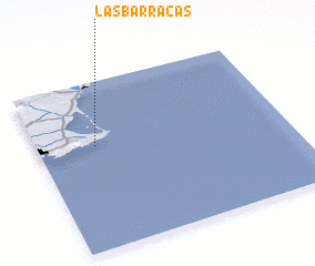 Places with similar names to Las Barracas, Spain ::
// Los Abregos (PA)
// Las Barracas (ES)
// Las Barracas (ES)
// Las Barracas (ES)
// Les Barraques (ES)
// Los Barcos (CO)
// Los Barcos (GT)
// Las Barracas (MX)
// Las Borregas (MX)
// Las Borregas (MX)
Disclaimer :: Information on this page comes without warranty of any kind |
||
|
Where is Las Barracas? Elevation and coordinates ::
Latitude (lat): 37°37'0"N Longitude (lon): 0°46'0"W
Elevation (approx.): 57m (map arrows pan, magnifying glasses zoom) |
||
|
Visiting Las Barracas? Hotel/Accommodation ::
Book a hotel in Las Barracas Travel Guide ::
Buy a travel guide for Spain rental cars ::
car rental offers GPS waypoint ::
download a GPX waypoint (PoI) of Las Barracas for your GPS receiver
|
||