|
search place name
|
||
Loro (Asturias, Spain)Loro is a town in the Asturias region of Spain. An overview map of the region around Loro is displayed below.
regional and 3d topo map of Loro, Spain ::

Loro airports ::
The nearest airport is OVD - Aviles Asturias, located 16.1 km north east of Loro.
Other airports nearby include BGC - Braganca (185.3 km south), VLL - Valladolid (226.3 km south east), Nearby towns ::
Folgueras (1.9km south) //
Villavaler (1.3km east) //
Palación (1.3km east) //
Sangreña (1.9km north) //
San Bartolomé (1.9km north) //
Villamondrid (2.3km south west) //
Malleza (2.3km south west) //
Cordovero (2.3km south west) //
Omedas (2.3km north east) //
Ablanedo (2.3km north west) //
La Peral (3.7km south) //
Las Piñeras (3.7km south) //
Villarín (2.7km west) //
Selgas de Arriba (2.7km east) //
Inclán (2.7km east) //
Carceda (3.7km north) //
Allence (3.3km south east) //
San Martín de Arango (3.3km south east) //
La Arquera (3.3km south west) //
Linares (3.9km south) //
Godina (3.3km north east) //
Villameján (3.3km north east) //
La Tabla (3.9km north) //
Orderías (3.9km north) //
Faedo (4.6km north east) //
San Cristóbal (4.6km north east) //
Santullano (5.6km south) //
Mouroso (5.6km south) //
Selgas de Abajo (4.0km east) //
[all distances 'as the bird flies' and approximate] 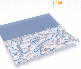 Places with similar names to Loro, Spain ::
Disclaimer :: Information on this page comes without warranty of any kind |
||
|
Where is Loro? Elevation and coordinates ::
Latitude (lat): 43°29'0"N Longitude (lon): 6°12'0"W
Elevation (approx.): 301m (map arrows pan, magnifying glasses zoom) |
||
|
Visiting Loro? Hotel/Accommodation ::
Book a hotel in Loro Travel Guide ::
Buy a travel guide for Spain rental cars ::
car rental offers GPS waypoint ::
download a GPX waypoint (PoI) of Loro for your GPS receiver
|
||