|
search place name
|
||
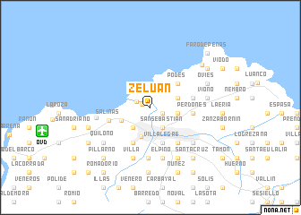
Zeluán (Asturias, Spain)Zeluán is a town in the Asturias region of Spain. An overview map of the region around Zeluán is displayed below.
regional and 3d topo map of Zeluán, Spain ::
Zeluán airports ::
The nearest airport is OVD - Aviles Asturias, located 10.2 km west of Zeluán.
Other airports nearby include BGC - Braganca (203.1 km south), VLL - Valladolid (226.6 km south east), Nearby towns ::
Llodero (1.1km north) //
San Juan de Nieva (0.9km north west) //
Campo de la Iglesia (1.3km south east) //
Nieva (1.4km north west) //
San Sebastián (2.8km south east) //
Navarro (2.8km south east) //
Caliero (3.0km south west) //
Entreviñas (3.0km south west) //
Lloreda (3.2km north) //
Monteril (3.2km north) //
Ambiedes (2.6km east) //
Barreda (2.6km east) //
Iboya (2.7km north east) //
Avilés (3.7km south) //
Raíces (3.1km south west) //
Granda (3.9km north east) //
Podes (3.9km north east) //
Llaranes (4.6km south) //
Villalegre (4.6km south) //
Heros (4.7km south) //
Perdones (3.9km east) //
Ferrera (4.0km east) //
Manzaneda (4.0km east) //
Salinas (4.1km south west) //
Marzaniella (5.1km south east) //
Lloreda (6.3km south) //
Molleda (6.3km south) //
Corros (6.3km south) //
El Pino (6.4km south) //
[all distances 'as the bird flies' and approximate] 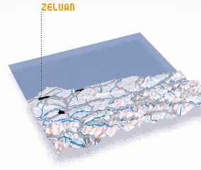 Places with similar names to Zeluán, Spain ::
Disclaimer :: Information on this page comes without warranty of any kind |
||
|
Where is Zeluán? Elevation and coordinates ::
Latitude (lat): 43°35'23"N Longitude (lon): 5°54'50"W
Elevation (approx.): 3m (map arrows pan, magnifying glasses zoom) |
||
|
Visiting Zeluán? Hotel/Accommodation ::
Book a hotel in Zeluán Travel Guide ::
Buy a travel guide for Spain rental cars ::
car rental offers GPS waypoint ::
download a GPX waypoint (PoI) of Zeluán for your GPS receiver
|
||