|
search place name
|
||
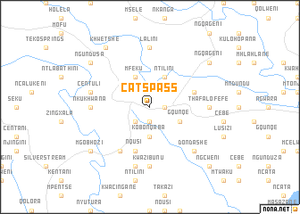
Catʼs Pass (South Africa)Catʼs Pass is a town in South Africa. An overview map of the region around Catʼs Pass is displayed below.
regional and 3d topo map of Catʼs Pass, South Africa ::
Catʼs Pass airports ::
The nearest airport is ELS - East London, located 86.8 km south west of Catʼs Pass.
Other airports nearby include UTT - Umtata Mthatha (101.2 km north), VIY - Bisho Bhisho (118.5 km south west), UTW - Queenstown (155.5 km west), MGH - Margate (252.8 km north east), Nearby towns ::
Bakaneni (1.6km east) //
Mntla (1.9km south) //
Nxaxo (2.4km south west) //
Kobonqaba (3.7km south) //
Ntilini (4.0km north east) //
Gqunqe (3.6km south east) //
Mfeku (4.0km north west) //
Mampondweni (5.0km east) //
Nqusi (5.8km south) //
Columba (6.4km south west) //
Lalini (7.4km north) //
Lusizi (6.3km east) //
Thafa-Lofefe (6.3km east) //
Nkukhwana (6.3km west) //
KwaZibunu (7.4km south) //
Centuli (6.5km west) //
KwaMacibe (7.6km south) //
Dondashe (7.3km south east) //
Khwetshe (8.8km north west) //
Ngqageni (8.4km north east) //
Mgobhozi (8.4km south west) //
Ngundusa (8.4km north west) //
Ngcweni (9.7km south east) //
[all distances 'as the bird flies' and approximate] 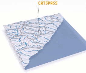 Places with similar names to Catʼs Pass, South Africa :: Disclaimer :: Information on this page comes without warranty of any kind |
||
|
Where is Catʼs Pass? Elevation and coordinates ::
Latitude (lat): 32°26'0"S Longitude (lon): 28°25'0"E
Elevation (approx.): 419m (map arrows pan, magnifying glasses zoom) |
||
|
Visiting Catʼs Pass? Hotel/Accommodation ::
Book a hotel in Catʼs Pass Travel Guide ::
rental cars ::
car rental offers GPS waypoint ::
download a GPX waypoint (PoI) of Catʼs Pass for your GPS receiver
|
||