|
search place name
|
||
Aleksandrovka (Smolenskaya Oblast', Russia)Aleksandrovka is a town in the Smolenskaya Oblast' region of Russia. An overview map of the region around Aleksandrovka is displayed below.
regional and 3d topo map of Aleksandrovka, Russia ::

Aleksandrovka airports ::
The nearest airport is VTB - Vitebsk, located 153.2 km north west of Aleksandrovka.
Other airports nearby include GME - Gomel (195.5 km south), Nearby towns ::
Uskosy (2.5km south) //
Bratkovaya (2.2km south west) //
Gorodchanka (2.7km south west) //
Bol'shiye Lyzki (4.2km north) //
Zamosh'ye (3.0km north west) //
Osinovka (5.2km north) //
Stayki (6.3km south west) //
Pykovka (7.4km south) //
Pritykino (6.3km north west) //
Zarech'ye (5.2km south west) //
Semënovka (8.6km north) //
Mikhaylovka (5.8km north west) //
Triputino (5.5km south east) //
Korzovo (6.0km north east) //
Sloboda (7.4km north east) //
Gololobovka (7.9km north west) //
Dobryanka (9.3km north) //
Shaporova Buda (9.0km south east) //
[all distances 'as the bird flies' and approximate] 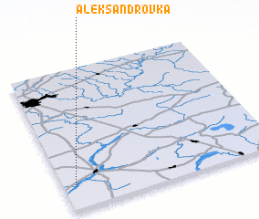 Places with similar names to Aleksandrovka, Russia ::
// Aleksandrivka (UA)
// Aleksandrovka (UA)
// Aleksandrovka (UA)
// Aleksandrovka (UA)
// Aleksandrovka (UA)
// Aleksandrovka (UA)
// Aleksandrovka (UA)
// Aleksandrovka (UA)
// Aleksandrovka (UA)
// Aleksandrovka (UA)
Disclaimer :: Information on this page comes without warranty of any kind |
||
|
Where is Aleksandrovka? Elevation and coordinates ::
Latitude (lat): 54°10'12"N Longitude (lon): 32°3'22"E
Elevation (approx.): 182m (map arrows pan, magnifying glasses zoom) |
||
|
Visiting Aleksandrovka? Hotel/Accommodation ::
Book a hotel in Aleksandrovka Travel Guide ::
Buy a travel guide for Russia rental cars ::
car rental offers GPS waypoint ::
download a GPX waypoint (PoI) of Aleksandrovka for your GPS receiver
|
||