|
search place name
|
||
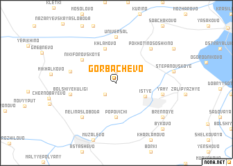
Gorbachëvo (Ryazanskaya Oblast', Russia)Gorbachëvo is a town in the Ryazanskaya Oblast' region of Russia. An overview map of the region around Gorbachëvo is displayed below.
regional and 3d topo map of Gorbachëvo, Russia ::
Nearby towns ::
Laskovo (1.9km north) //
Medvezh'ye (2.1km south west) //
Ist'ye (3.4km south east) //
Popovichi (5.6km south) //
Khlamovo (5.7km north) //
Nikiforovskoye (4.9km north west) //
Universal' (7.4km north) //
Yamy (4.7km south east) //
Alelëvo (4.7km north west) //
Bol'shiye Kuligi (4.7km south west) //
Nelina Sloboda (6.4km south west) //
Pokhotino-Soshkino (6.4km north east) //
Brennoye (7.0km south east) //
Bykovo (8.6km south east) //
[all distances 'as the bird flies' and approximate]  Places with similar names to Gorbachëvo, Russia ::
// Garibashevo (RU)
// Gorbachëvo (RU)
// Gorbachëvo (RU)
// Gorbachëvo (RU)
// Gorbachëvo (RU)
// Gorbachëvo (RU)
// Gorbachevo (RU)
// Karabashevo (RU)
// Karbysheva (RU)
// Gorbachëvo (BY)
Disclaimer :: Information on this page comes without warranty of any kind |
||
|
Where is Gorbachëvo? Elevation and coordinates ::
Latitude (lat): 54°19'0"N Longitude (lon): 40°4'0"E
Elevation (approx.): 128m (map arrows pan, magnifying glasses zoom) |
||
|
Visiting Gorbachëvo? Hotel/Accommodation ::
Book a hotel in Gorbachëvo Travel Guide ::
Buy a travel guide for Russia rental cars ::
car rental offers GPS waypoint ::
download a GPX waypoint (PoI) of Gorbachëvo for your GPS receiver
|
||