|
search place name
|
||
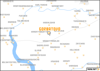
Gorbatovo (Ryazanskaya Oblast', Russia)Gorbatovo is a town in the Ryazanskaya Oblast' region of Russia. An overview map of the region around Gorbatovo is displayed below.
regional and 3d topo map of Gorbatovo, Russia ::
Gorbatovo airports ::
The nearest airport is VKO - Moscow Vnukovo, located 187.9 km north west of Gorbatovo.
Other airports nearby include SVO - Moscow Sheremetyevo (220.7 km north west), Nearby towns ::
Sadovyy Posëlok (3.0km south) //
Natalinka (2.2km east) //
Khokhlovka (4.0km north) //
Krasnyy Bogatyr' (2.4km west) //
Bychki (3.2km north west) //
Shepelëvka (4.9km south) //
Naumovka (5.4km south) //
Nichushki (5.2km south east) //
Glinka (7.0km south) //
Gornostayevka (8.8km south) //
[all distances 'as the bird flies' and approximate] 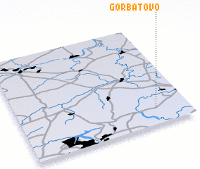 Places with similar names to Gorbatovo, Russia ::
// Karabutovo (UA)
// Gorbatov (RU)
// Gorbatov (RU)
// Gorbatovo (RU)
// Karabatovo (RU)
// Karbatovo (RU)
// Khrebtovo (RU)
// Khrebtovo (RU)
// Khrebtovo (RU)
// Khrebtovo (RU)
Disclaimer :: Information on this page comes without warranty of any kind |
||
|
Where is Gorbatovo? Elevation and coordinates ::
Latitude (lat): 54°9'30"N Longitude (lon): 38°48'28"E
Elevation (approx.): 189m (map arrows pan, magnifying glasses zoom) |
||
|
Visiting Gorbatovo? Hotel/Accommodation ::
Book a hotel in Gorbatovo Travel Guide ::
Buy a travel guide for Russia rental cars ::
car rental offers GPS waypoint ::
download a GPX waypoint (PoI) of Gorbatovo for your GPS receiver
|
||