|
search place name
|
||
Kotel'nikovo (Novgorodskaya Oblast', Russia)Kotel'nikovo is a town in the Novgorodskaya Oblast' region of Russia. An overview map of the region around Kotel'nikovo is displayed below.
regional and 3d topo map of Kotel'nikovo, Russia ::

Kotel'nikovo airports ::
The nearest airport is KLD - Tver Migalovo, located 202.9 km south east of Kotel'nikovo.
Nearby towns ::
Sychëvo (1.0km east) //
Maloye Fofankovo (1.0km west) //
Bol'shoye Fofankovo (1.9km west) //
Klement'yevo (3.8km south) //
Nikitino (3.8km north) //
Sosnovka (2.9km east) //
Ukroyevo (5.6km north) //
Glistnitsy (5.6km south) //
Sutoko-Ryadok (4.7km south west) //
Alënkino (5.9km north) //
Buregi (7.4km south) //
Ploskovo (7.5km north) //
Markovo (6.3km north east) //
Veresimovka (6.3km south west) //
Ruch'i (5.4km south east) //
Mikhalino (5.4km north east) //
Khlamovo (5.4km north east) //
Ushakovo (5.4km south west) //
Popovo (8.4km north west) //
[all distances 'as the bird flies' and approximate] 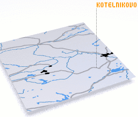 Places with similar names to Kotel'nikovo, Russia ::
// Kotel'nīkovo (KZ)
// Kotel'nikov (RU)
// Kotel'nikovo (RU)
// Kotel'nikovo (RU)
// Kotel'nikovo (RU)
// Kotel'nikovo (RU)
// Kotel'nikovo (RU)
// Kotel'nikovo (RU)
// Kotelʼnikovo (UA)
// Kotelʼnikov (KZ)
Disclaimer :: Information on this page comes without warranty of any kind |
||
|
Where is Kotel'nikovo? Elevation and coordinates ::
Latitude (lat): 58°18'0"N Longitude (lon): 33°46'0"E
Elevation (approx.): 151m (map arrows pan, magnifying glasses zoom) |
||
|
Visiting Kotel'nikovo? Hotel/Accommodation ::
Book a hotel in Kotel'nikovo Travel Guide ::
Buy a travel guide for Russia rental cars ::
car rental offers GPS waypoint ::
download a GPX waypoint (PoI) of Kotel'nikovo for your GPS receiver
|
||