|
search place name
|
||
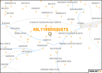
Malyy Panikovets (Orlovskaya Oblast', Russia)Malyy Panikovets is a town in the Orlovskaya Oblast' region of Russia. An overview map of the region around Malyy Panikovets is displayed below.
regional and 3d topo map of Malyy Panikovets, Russia ::
Malyy Panikovets airports ::
The nearest airport is VOZ - Voronezh Chertovitskoye, located 136.1 km east of Malyy Panikovets.
Nearby towns ::
Krasnyy (1.1km west) //
Khanyki (2.5km south) //
Nizhnyaya Zamarayka (2.2km north east) //
(( Borzënkov )) (1.9km east) //
Vtoraya Verkhnyaya Zamarayka (3.7km north) //
Verkhnyaya Zamarayka (3.9km north) //
Vyshnyaya Zamarayka Vtoraya (4.2km north) //
Ivanenkovo (3.2km south west) //
Kosorzha (4.8km south west) //
Bystra (3.4km east) //
Sulayevka (5.7km south) //
Novyye Saviny (6.1km south) //
Staryye Saviny (6.7km south) //
Yegor'yevka (4.6km west) //
Pervoye Nizhne-Dolgoye (4.6km east) //
Zapuski (4.9km west) //
Novoalekseyevskoye (4.9km east) //
Vtoroye Nizhne-Dolgoye (4.9km east) //
Kharskoye (7.7km north) //
Novo-Alekseyevskoye (5.9km south east) //
Dubrovka (7.8km north) //
Petrovka (5.3km west) //
Petrovka (5.4km west) //
Khokhlovka (5.6km west) //
Urynok (6.9km north east) //
Kryukovo (8.5km south west) //
[all distances 'as the bird flies' and approximate] 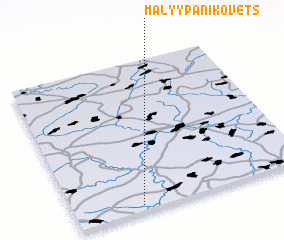 Places with similar names to Malyy Panikovets, Russia :: Disclaimer :: Information on this page comes without warranty of any kind |
||
|
Where is Malyy Panikovets? Elevation and coordinates ::
Latitude (lat): 52°2'0"N Longitude (lon): 37°17'0"E
Elevation (approx.): 195m (map arrows pan, magnifying glasses zoom) |
||
|
Visiting Malyy Panikovets? Hotel/Accommodation ::
Book a hotel in Malyy Panikovets Travel Guide ::
Buy a travel guide for Russia rental cars ::
car rental offers GPS waypoint ::
download a GPX waypoint (PoI) of Malyy Panikovets for your GPS receiver
|
||