|
search place name
|
||
Olokhovo (Novgorodskaya Oblast', Russia)Olokhovo is a town in the Novgorodskaya Oblast' region of Russia. An overview map of the region around Olokhovo is displayed below.
regional and 3d topo map of Olokhovo, Russia ::
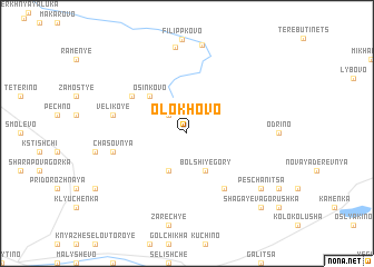
Nearby towns ::
Mditsy (2.1km north west) //
Borino (3.8km south) //
Bol'shiye Gory (3.8km south) //
Osinkovo (4.2km north west) //
Zagolov'ye (5.9km south) //
Zabludyashchaya Gorka (4.7km north west) //
Chasovnya (4.3km south west) //
Velikoye (4.2km north west) //
Okulovo (4.2km north west) //
Nesterova Gorka (8.7km north) //
Vesnino (8.9km north) //
Peschanitsa (6.8km south east) //
Shagayeva Gorushka (8.3km south east) //
[all distances 'as the bird flies' and approximate] 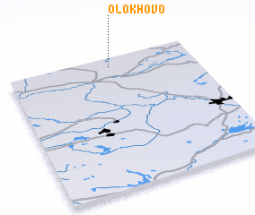 Places with similar names to Olokhovo, Russia ::
Disclaimer :: Information on this page comes without warranty of any kind |
||
|
Where is Olokhovo? Elevation and coordinates ::
Latitude (lat): 58°56'0"N Longitude (lon): 33°33'0"E
Elevation (approx.): 231m (map arrows pan, magnifying glasses zoom) |
||
|
Visiting Olokhovo? Hotel/Accommodation ::
Book a hotel in Olokhovo Travel Guide ::
Buy a travel guide for Russia rental cars ::
car rental offers GPS waypoint ::
download a GPX waypoint (PoI) of Olokhovo for your GPS receiver
|
||