|
search place name
|
||
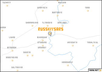
Russkiy Sars (Permskaya Oblast', Russia)Russkiy Sars is a town in the Permskaya Oblast' region of Russia. An overview map of the region around Russkiy Sars is displayed below.
regional and 3d topo map of Russkiy Sars, Russia ::
Russkiy Sars airports ::
The nearest airport is UFA - Ufa, located 198.4 km south west of Russkiy Sars.
Other airports nearby include PEE - Perm Bolshoye Savino (201.9 km north), Nearby towns ::
Ust'-Savarovo (2.4km north east) //
Ishimovka (2.4km south west) //
Tlyakova (4.0km north) //
Otsadino (3.9km south west) //
Ural-Mari (4.6km north east) //
Urshady (5.6km south) //
Sharapovka (5.4km north west) //
Burtsevo (7.7km north) //
Vayeshta (5.7km south east) //
Chikur (8.2km south west) //
Shveya (8.7km south west) //
[all distances 'as the bird flies' and approximate] 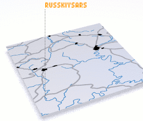 Places with similar names to Russkiy Sars, Russia :: Disclaimer :: Information on this page comes without warranty of any kind |
||
|
Where is Russkiy Sars? Elevation and coordinates ::
Latitude (lat): 56°11'54"N Longitude (lon): 57°5'41"E
Elevation (approx.): 183m (map arrows pan, magnifying glasses zoom) |
||
|
Visiting Russkiy Sars? Hotel/Accommodation ::
Book a hotel in Russkiy Sars Travel Guide ::
Buy a travel guide for Russia rental cars ::
car rental offers GPS waypoint ::
download a GPX waypoint (PoI) of Russkiy Sars for your GPS receiver
|
||