|
search place name
|
||
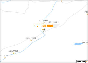
Sandalovo (Altayskiy Kray, Russia)Sandalovo is a town in the Altayskiy Kray region of Russia. An overview map of the region around Sandalovo is displayed below.
regional and 3d topo map of Sandalovo, Russia ::
Sandalovo airports ::
The nearest airport is BAX - Barnaul, located 55.9 km south east of Sandalovo.
Nearby towns ::
Makarikha (3.7km north) //
Larichikha (3.7km north east) //
Shelëpovo (5.0km south west) //
[all distances 'as the bird flies' and approximate]  Places with similar names to Sandalovo, Russia ::
// Saint Olaf (US)
// Santa Oliva (ES)
// San Adolfo (CO)
// Santa Elva (PE)
// Saint-Éliph (FR)
// Sainte-Olive (FR)
// Saint-Oulph (FR)
// SantʼAlfio (IT)
// SantʼOliva (IT)
// Sandelva (NO)
Disclaimer :: Information on this page comes without warranty of any kind |
||
|
Where is Sandalovo? Elevation and coordinates ::
Latitude (lat): 53°45'0"N Longitude (lon): 83°0'0"E
Elevation (approx.): 168m (map arrows pan, magnifying glasses zoom) |
||
|
Visiting Sandalovo? Hotel/Accommodation ::
Book a hotel in Sandalovo Travel Guide ::
Buy a travel guide for Russia rental cars ::
car rental offers GPS waypoint ::
download a GPX waypoint (PoI) of Sandalovo for your GPS receiver
|
||