|
search place name
|
||
Shirokoye Boloto (Kurskaya Oblast', Russia)Shirokoye Boloto is a town in the Kurskaya Oblast' region of Russia. An overview map of the region around Shirokoye Boloto is displayed below.
regional and 3d topo map of Shirokoye Boloto, Russia ::

Nearby towns ::
Kleninskiy (2.9km north east) //
Ponyri Pervyye (3.3km south) //
Sorevnovaniye (2.9km north west) //
Buzuluk (3.0km north east) //
Pervoye Maya (4.5km south east) //
Ponyri (5.5km south) //
Ochki (3.7km north west) //
Maslovo (5.6km north) //
Nikol'skoye (4.1km north west) //
Khitrova (6.0km north east) //
Vasil'yevskiy (7.0km north) //
Rzhavets (5.0km south west) //
Berëzovyy Log (8.2km south west) //
Vasil'yevka (8.1km north east) //
Glazunova (8.1km north east) //
Soglasnyy (7.2km north east) //
Arkhangel'skoye (6.5km north west) //
Aleksandrovka Vtoraya (8.7km north east) //
Aleksandrovka Pervaya (8.7km north east) //
Goreloye (8.8km south east) //
Aleksandrovka (9.4km north east) //
[all distances 'as the bird flies' and approximate] 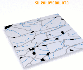 Places with similar names to Shirokoye Boloto, Russia :: Disclaimer :: Information on this page comes without warranty of any kind |
||
|
Where is Shirokoye Boloto? Elevation and coordinates ::
Latitude (lat): 52°22'3"N Longitude (lon): 36°17'53"E
Elevation (approx.): 233m (map arrows pan, magnifying glasses zoom) |
||
|
Visiting Shirokoye Boloto? Hotel/Accommodation ::
Book a hotel in Shirokoye Boloto Travel Guide ::
Buy a travel guide for Russia rental cars ::
car rental offers GPS waypoint ::
download a GPX waypoint (PoI) of Shirokoye Boloto for your GPS receiver
|
||