|
search place name
|
||
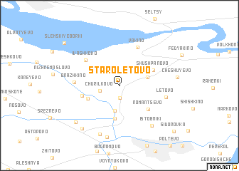
Staroletovo (Ryazanskaya Oblast', Russia)Staroletovo is a town in the Ryazanskaya Oblast' region of Russia. An overview map of the region around Staroletovo is displayed below.
regional and 3d topo map of Staroletovo, Russia ::
Nearby towns ::
Nagornoye (1.9km south) //
Churilkovo (1.9km south west) //
Staroye Baturino (4.0km south) //
Demidovo (2.9km north east) //
Novoye Baturino (5.2km south) //
Vysokoye (3.5km south west) //
Shushpanovo (3.9km north east) //
Romantsevo (4.6km south east) //
Chemrovo (3.7km south west) //
Vakino (6.2km north) //
Ivashkovo (5.1km north west) //
Brazhkino (4.1km west) //
Letovo (4.6km south east) //
Istobniki (6.9km south east) //
Novoye Veselëvo (7.8km south) //
Yurkino (8.2km south) //
Staroye Veselëvo (7.5km south west) //
Vysokovo (7.0km south west) //
Slëmskiye Borki (8.3km north west) //
Sidorovka (8.7km south east) //
[all distances 'as the bird flies' and approximate]  Places with similar names to Staroletovo, Russia ::
// Střelítov (CZ)
Disclaimer :: Information on this page comes without warranty of any kind |
||
|
Where is Staroletovo? Elevation and coordinates ::
Latitude (lat): 54°49'7"N Longitude (lon): 39°27'41"E
Elevation (approx.): 129m (map arrows pan, magnifying glasses zoom) |
||
|
Visiting Staroletovo? Hotel/Accommodation ::
Book a hotel in Staroletovo Travel Guide ::
Buy a travel guide for Russia rental cars ::
car rental offers GPS waypoint ::
download a GPX waypoint (PoI) of Staroletovo for your GPS receiver
|
||