|
search place name
|
||
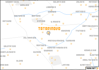
Tatarinovo (Moskovskaya Oblast', Russia)Tatarinovo is a town in the Moskovskaya Oblast' region of Russia. An overview map of the region around Tatarinovo is displayed below.
regional and 3d topo map of Tatarinovo, Russia ::
Tatarinovo airports ::
The nearest airport is VKO - Moscow Vnukovo, located 60.4 km north west of Tatarinovo.
Other airports nearby include SVO - Moscow Sheremetyevo (90.9 km north), Nearby towns ::
Rudiny (1.9km north west) //
Vel'yaminovskiy (2.2km south west) //
Tishkovo (3.3km north east) //
Proyekurnikovo (3.6km south east) //
Il'inskoye (4.2km north) //
Syr'yëvo (4.5km north) //
Nemtsovo (5.4km south) //
Kaverino (3.7km east) //
Konstantinovskoye (6.2km south) //
Lyakhovo (5.3km north east) //
Sidorovo (7.0km south) //
Vel'yaminovo (4.7km south west) //
Uvarovo (7.8km north) //
Barybino (6.8km north west) //
Kunavina (5.7km south east) //
Mikhnëvo (8.8km south) //
Kuz'mino (8.1km south) //
Vvedenskoye (9.2km north east) //
[all distances 'as the bird flies' and approximate] 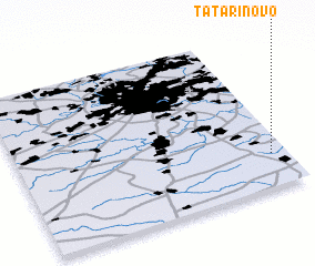 Places with similar names to Tatarinovo, Russia ::
// Tatarinovo (RU)
// Tatarinovo (RU)
// Tatarinovo (RU)
// Tatarinovo (RU)
// Tatarinovo (RU)
// Tatarinovo (RU)
// Tatarinovo (RU)
// Tatariniv (UA)
Disclaimer :: Information on this page comes without warranty of any kind |
||
|
Where is Tatarinovo? Elevation and coordinates ::
Latitude (lat): 55°12'45"N Longitude (lon): 37°56'34"E
Elevation (approx.): 187m (map arrows pan, magnifying glasses zoom) |
||
|
Visiting Tatarinovo? Hotel/Accommodation ::
Book a hotel in Tatarinovo Travel Guide ::
Buy a travel guide for Russia rental cars ::
car rental offers GPS waypoint ::
download a GPX waypoint (PoI) of Tatarinovo for your GPS receiver
|
||