|
search place name
|
||
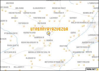
Utrennyaya Zvezda (Orlovskaya Oblast', Russia)Utrennyaya Zvezda is a town in the Orlovskaya Oblast' region of Russia. An overview map of the region around Utrennyaya Zvezda is displayed below.
regional and 3d topo map of Utrennyaya Zvezda, Russia ::
Utrennyaya Zvezda airports ::
The nearest airport is VOZ - Voronezh Chertovitskoye, located 168.8 km south east of Utrennyaya Zvezda.
Nearby towns ::
Petushki (1.7km north) //
Podvysokoye (2.2km south west) //
Bobrik (3.0km south) //
Kozlovka (3.1km south west) //
Potapovka (3.7km south) //
Sarychëvka (3.9km south) //
Pogorelovka (3.9km south) //
Mikhaylovskoye (2.9km south west) //
Dubrovka (2.9km south west) //
Rayëvka (3.9km north west) //
Golyayevka (5.6km north) //
Luzhnoy (5.7km north) //
Duby (3.7km west) //
Kon'-Kamen' (5.0km north west) //
Troyanovka (6.0km north) //
Troyanovka (6.0km north) //
Yelaginskiy (7.4km south) //
Murav'yëvka (4.5km west) //
Nikitino (6.1km south east) //
Ponizovka (4.8km east) //
Khomutovo (6.0km south west) //
Zhuravlinovka (7.8km north) //
Chigirinovka (4.8km east) //
Novaya Derevnya (5.8km south west) //
Travinskiy (7.7km north) //
Obnovlënnaya Zemlya (7.7km south) //
Yelagino (6.9km south east) //
Sukhoy (8.1km north east) //
Kamenka (7.1km south east) //
[all distances 'as the bird flies' and approximate] 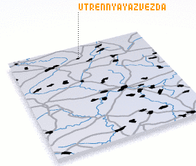 Places with similar names to Utrennyaya Zvezda, Russia ::
// (( Utrennyaya Zvezda )) (RU)
Disclaimer :: Information on this page comes without warranty of any kind |
||
|
Where is Utrennyaya Zvezda? Elevation and coordinates ::
Latitude (lat): 52°54'0"N Longitude (lon): 37°30'0"E
Elevation (approx.): 239m (map arrows pan, magnifying glasses zoom) |
||
|
Visiting Utrennyaya Zvezda? Hotel/Accommodation ::
Book a hotel in Utrennyaya Zvezda Travel Guide ::
Buy a travel guide for Russia rental cars ::
car rental offers GPS waypoint ::
download a GPX waypoint (PoI) of Utrennyaya Zvezda for your GPS receiver
|
||