|
search place name
|
||
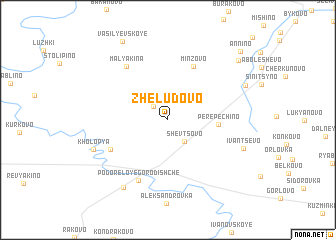
Zhëludovo (Tverskaya Oblast', Russia)Zhëludovo is a town in the Tverskaya Oblast' region of Russia. An overview map of the region around Zhëludovo is displayed below.
regional and 3d topo map of Zhëludovo, Russia ::
Zhëludovo airports ::
The nearest airport is KLD - Tver Migalovo, located 85.6 km north east of Zhëludovo.
Nearby towns ::
Bolsunovo (1.8km north west) //
Shevtsovo (2.6km south east) //
Perepechino (3.2km east) //
Minzovo (6.2km north) //
Vyshnyakovo (4.9km south west) //
Pogoreloye Gorodishche (6.9km south) //
Mal'yakina (6.5km north west) //
Kholop'ya (5.7km south west) //
Ivantsëvo (5.7km south east) //
Kopylovo (8.0km south) //
Mitino (6.1km north east) //
Vasil'yevskoye (9.2km north) //
Kalachëvo (8.0km north east) //
Annino (8.9km north east) //
[all distances 'as the bird flies' and approximate] 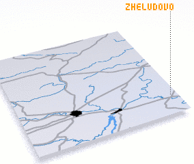 Places with similar names to Zhëludovo, Russia ::
Disclaimer :: Information on this page comes without warranty of any kind |
||
|
Where is Zhëludovo? Elevation and coordinates ::
Latitude (lat): 56°11'47"N Longitude (lon): 34°57'29"E
Elevation (approx.): 225m (map arrows pan, magnifying glasses zoom) |
||
|
Visiting Zhëludovo? Hotel/Accommodation ::
Book a hotel in Zhëludovo Travel Guide ::
Buy a travel guide for Russia rental cars ::
car rental offers GPS waypoint ::
download a GPX waypoint (PoI) of Zhëludovo for your GPS receiver
|
||