|
search place name
|
||
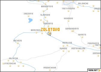
Zolotovo (Leningradskaya Oblast', Russia)Zolotovo is a town in the Leningradskaya Oblast' region of Russia. An overview map of the region around Zolotovo is displayed below.
regional and 3d topo map of Zolotovo, Russia ::
Nearby towns ::
Maksimova Gora (1.5km north) //
Kolbeki (3.1km north) //
Bol'shoye Boloto (1.9km north west) //
Zaruchev'ye (3.8km north) //
Bol'shaya Gora (3.8km north) //
Podgor'ye (3.8km north) //
Berëzoviki (3.0km north west) //
Moshnya (5.6km north) //
Nosovo (5.5km north) //
Drochilovo (4.4km south east) //
Mozolevo (4.6km south east) //
Selishche (6.3km north) //
Pupovo (6.0km south east) //
Slavkovo (7.1km north) //
Dorokhovaya (4.4km north east) //
Mikhnovo (6.6km north east) //
Zabrusen'ye (4.7km north east) //
Zapol'ye (6.6km south east) //
Zaozër'ye (8.6km north west) //
[all distances 'as the bird flies' and approximate]  Places with similar names to Zolotovo, Russia ::
Disclaimer :: Information on this page comes without warranty of any kind |
||
|
Where is Zolotovo? Elevation and coordinates ::
Latitude (lat): 59°20'58"N Longitude (lon): 33°47'26"E
Elevation (approx.): 71m (map arrows pan, magnifying glasses zoom) |
||
|
Visiting Zolotovo? Hotel/Accommodation ::
Book a hotel in Zolotovo Travel Guide ::
Buy a travel guide for Russia rental cars ::
car rental offers GPS waypoint ::
download a GPX waypoint (PoI) of Zolotovo for your GPS receiver
|
||