|
search place name
|
||
West Centreville (Alabama, United States - USA)West Centreville is a town in the Alabama region of United States - USA. An overview map of the region around West Centreville is displayed below.
regional and 3d topo map of West Centreville, United States - USA ::

West Centreville airports ::
The nearest airport is BHM - Birmingham Intl, located 77.6 km north east of West Centreville.
Other airports nearby include MXF - Montgomery Maxwell Afb (95.9 km south east), NMM - Meridian Nas (139.4 km west), ANB - Anniston Metro (139.4 km north east), CBM - Colombus Columbus Afb (143.9 km north west), Nearby towns ::
Centreville (0.4km east) //
East Centreville (0.7km east) //
Zulu (1.1km south) //
East Town (1.0km east) //
Fairdale (1.5km south) //
Brent (2.2km west) //
Jamesville (4.7km south west) //
Choctaw Hills (4.9km north west) //
Goodson (5.2km south west) //
Gary Springs (5.7km north east) //
Vick (5.6km east) //
Pleasant Hill (7.0km north west) //
Ingate (7.3km west) //
Duff Settlement (8.0km south west) //
[all distances 'as the bird flies' and approximate] 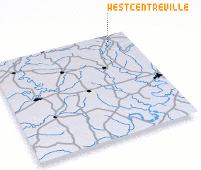 Places with similar names to West Centreville, United States - USA :: Disclaimer :: Information on this page comes without warranty of any kind |
||
|
Where is West Centreville? Elevation and coordinates ::
Latitude (lat): 32°56'40"N Longitude (lon): 87°8'34"W
Elevation (approx.): 69m (map arrows pan, magnifying glasses zoom) |
||
|
Visiting West Centreville? Hotel/Accommodation ::
Book a hotel in West Centreville Travel Guide ::
rental cars ::
car rental offers GPS waypoint ::
download a GPX waypoint (PoI) of West Centreville for your GPS receiver
|
||