|
search place name
|
||
Sunrise Heights Mobile Home Park (Arizona, United States - USA)Sunrise Heights Mobile Home Park is a town in the Arizona region of United States - USA. An overview map of the region around Sunrise Heights Mobile Home Park is displayed below.
regional and 3d topo map of Sunrise Heights Mobile Home Park, United States - USA ::

Sunrise Heights Mobile Home Park airports ::
The nearest airport is PHX - Phoenix Sky Harbor Intl, located 23.9 km south of Sunrise Heights Mobile Home Park.
Other airports nearby include LUF - Phoenix Luke Afb (33.6 km west), PRC - Prescott Ernest A Love Fld (116.8 km north), DMA - Tucson Davis Monthan Afb (197.1 km south east), TUS - Tucson Intl (198.9 km south east), Nearby towns ::
Rollin W Mobile Home Ranch (0.6km east) //
Eighteen Bells Mobile Home Park (0.8km south east) //
Moon Valley Mobile Home Estates (0.9km south west) //
Desert Bell Estates II (1.0km north) //
Michigan Palms Mobile Home Park (1.4km north east) //
Bona Venture Mobile Home Park (1.5km west) //
Suncrest Villas East (1.7km south east) //
Greentrails (1.7km south west) //
Seven Palms Mobile Home Estates (1.7km west) //
Pepper Ridge (1.7km east) //
Paradise City (1.8km south east) //
Paradise North Mobile Home Park (1.8km east) //
Val Vista Trailer Park (1.9km north east) //
El Camino Mobile Home Park (1.8km east) //
The Town Square (2.1km west) //
Quail Country Place (2.1km west) //
Sunset Hills (2.5km south east) //
Villa Carmel Mobile Home Park (2.4km south east) //
Turtle Creek (2.4km south west) //
Paradise Shadows Mobile Home Park (2.5km north east) //
The Phoenix-Scottsdale Mobile Home Park (2.8km south east) //
Mountain Vista (2.8km east) //
Central Park Village (2.8km west) //
Liberty Mobile Home Park (3.0km north east) //
Aire Libre Mobile Home Park (3.0km east) //
Lookout Mountain (3.3km south east) //
Valley View (3.0km west) //
Paradise Valley Mobilhome Park (3.1km south east) //
Cave Creek (3.7km south) //
[all distances 'as the bird flies' and approximate] 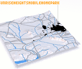 Places with similar names to Sunrise Heights Mobile Home Park, United States - USA :: Disclaimer :: Information on this page comes without warranty of any kind |
||
|
Where is Sunrise Heights Mobile Home Park? Elevation and coordinates ::
Latitude (lat): 33°38'53"N Longitude (lon): 112°2'50"W
Elevation (approx.): 434m (map arrows pan, magnifying glasses zoom) |
||
|
Visiting Sunrise Heights Mobile Home Park? Hotel/Accommodation ::
Book a hotel in Sunrise Heights Mobile Home Park Travel Guide ::
rental cars ::
car rental offers GPS waypoint ::
download a GPX waypoint (PoI) of Sunrise Heights Mobile Home Park for your GPS receiver
|
||