|
search place name
|
||
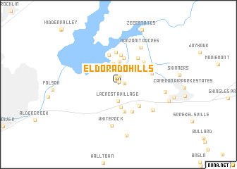
El Dorado Hills (California, United States - USA)El Dorado Hills is a town in the California region of United States - USA. An overview map of the region around El Dorado Hills is displayed below.
regional and 3d topo map of El Dorado Hills, United States - USA ::
El Dorado Hills airports ::
The nearest airport is RIU - Rancho Murieta, located 22.2 km south of El Dorado Hills.
Other airports nearby include MCC - Sacramento Mc Clellan Afld (27.9 km west), SAC - Sacramento Executive (40.7 km south west), SMF - Sacramento Intl (44.4 km west), BAB - Marysville Beale Afb (58.7 km north west), Nearby towns ::
Governors Village (0.3km north) //
Stonegate Village (0.7km east) //
Crown Village (1.1km north) //
Saint Andrews Village (1.3km north) //
Franciscan Village (2.3km north) //
Highland Village (2.5km north) //
Hidden Valley (2.5km north) //
La Cresta Village (2.6km south) //
Green Valley Acres (3.1km north) //
Marina Village (3.3km north) //
Winterhaven Village (3.6km north) //
Crescent Ridge Village (3.6km south) //
Lakeridge Oaks (3.7km north west) //
Equestrian Village (4.2km north) //
Springfield Meadows (4.4km south) //
Green Springs Valley (4.0km north east) //
Waterford Village (4.6km north) //
Clarksville (4.3km south east) //
Summit Village (4.8km north) //
Sunset Mobile Home Park (4.7km south) //
Lake Hills Estates (5.1km north) //
Arroyo Vista (4.8km north east) //
Hickok Ranch (4.7km north east) //
Green Springs Ranch (4.5km north east) //
White Rock (6.6km south) //
Marble Mountain (5.8km south east) //
Manzanita Acres (6.4km north east) //
Briarwood Canyon (6.0km east) //
Malby Crossing (8.1km south) //
[all distances 'as the bird flies' and approximate]  Places with similar names to El Dorado Hills, United States - USA ::
// Eldorado Hills (US)
Disclaimer :: Information on this page comes without warranty of any kind |
||
|
Where is El Dorado Hills? Elevation and coordinates ::
Latitude (lat): 38°41'9"N Longitude (lon): 121°4'52"W
Elevation (approx.): 231m (map arrows pan, magnifying glasses zoom) |
||
|
Visiting El Dorado Hills? Hotel/Accommodation ::
Book a hotel in El Dorado Hills Travel Guide ::
rental cars ::
car rental offers GPS waypoint ::
download a GPX waypoint (PoI) of El Dorado Hills for your GPS receiver
|
||