|
search place name
|
||
Glen Oaks (California, United States - USA)Glen Oaks is a town in the California region of United States - USA. An overview map of the region around Glen Oaks is displayed below.
regional and 3d topo map of Glen Oaks, United States - USA ::

Glen Oaks airports ::
The nearest airport is NKX - Miramar Mcas, located 32.0 km west of Glen Oaks.
Other airports nearby include TIJ - Tijuana General Abelardo L Rodriguez Intl (36.5 km south west), SAN - San Diego Intl (38.0 km west), NZY - San Diego North Island Nas (41.6 km west), NJK - El Centro Naf (105.9 km east), Nearby towns ::
Alpine Heights (3.1km south east) //
Harbison Canyon (3.2km south west) //
Alpine (3.5km east) //
Flinn Springs (4.9km west) //
Blossom Valley (6.0km north west) //
La Cresta (6.3km south west) //
Suncrest (6.8km south west) //
Crest (6.9km south west) //
Dehesa (7.8km south west) //
[all distances 'as the bird flies' and approximate] 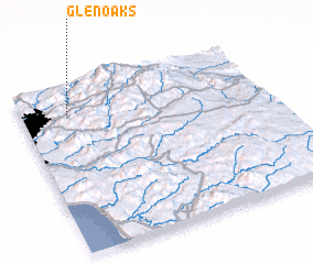 Places with similar names to Glen Oaks, United States - USA ::
// Glen Oaks (US)
// Glen Oaks (US)
// Glen Oaks (US)
// Glen Oaks (US)
// Klein Kiesow (DE)
// Klein Quassow (DE)
// Glińcz (PL)
// Gołańcz (PL)
// Kolińcz (PL)
// Kolnekas (AL)
Disclaimer :: Information on this page comes without warranty of any kind |
||
|
Where is Glen Oaks? Elevation and coordinates ::
Latitude (lat): 32°50'18"N Longitude (lon): 116°48'11"W
Elevation (approx.): 391m (map arrows pan, magnifying glasses zoom) |
||
|
Visiting Glen Oaks? Hotel/Accommodation ::
Book a hotel in Glen Oaks Travel Guide ::
rental cars ::
car rental offers GPS waypoint ::
download a GPX waypoint (PoI) of Glen Oaks for your GPS receiver
|
||