|
search place name
|
||
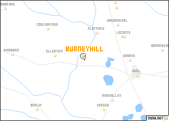
Burney Hill (Georgia, United States - USA)Burney Hill is a town in the Georgia region of United States - USA. An overview map of the region around Burney Hill is displayed below.
regional and 3d topo map of Burney Hill, United States - USA ::
Burney Hill airports ::
The nearest airport is VAD - Valdosta Moody Afb, located 38.8 km south east of Burney Hill.
Other airports nearby include TLH - Tallahassee Rgnl (116.0 km south west), WRB - Macon Robins Afb (163.6 km north), MCN - Macon Middle Georgia Rgnl (169.7 km north), DHN - Dothan Rgnl (183.8 km west), Nearby towns ::
Ellenton (5.7km west) //
Flat Ford (6.6km north) //
Barneyville (8.9km north east) //
Laconte (9.2km north east) //
Cool Springs (9.9km north west) //
Pine Valley (10.2km south east) //
Wagon Wheel (10.1km north east) //
[all distances 'as the bird flies' and approximate]  Places with similar names to Burney Hill, United States - USA ::
// Barren Hollow (US)
// Barnhill (US)
// Brown Hill (US)
// Barnhill (US)
// Barnhill (US)
// Barren Hill (US)
// Brown Hill (US)
// Barnhill (US)
// Brown Hill (US)
// Barunhāl (BD)
Disclaimer :: Information on this page comes without warranty of any kind |
||
|
Where is Burney Hill? Elevation and coordinates ::
Latitude (lat): 31°9'58"N Longitude (lon): 83°31'43"W
Elevation (approx.): 79m (map arrows pan, magnifying glasses zoom) |
||
|
Visiting Burney Hill? Hotel/Accommodation ::
Book a hotel in Burney Hill Travel Guide ::
rental cars ::
car rental offers GPS waypoint ::
download a GPX waypoint (PoI) of Burney Hill for your GPS receiver
|
||