|
search place name
|
||
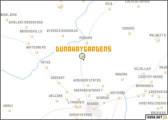
Dunaway Gardens (Georgia, United States - USA)Dunaway Gardens is a town in the Georgia region of United States - USA. An overview map of the region around Dunaway Gardens is displayed below.
regional and 3d topo map of Dunaway Gardens, United States - USA ::
Dunaway Gardens airports ::
The nearest airport is ATL - Hartsfield Jackson Atlanta Intl, located 40.3 km north east of Dunaway Gardens.
Other airports nearby include MGE - Marietta Dobbins Arb (Atlanta Nas) (56.0 km north east), ANB - Anniston Metro (97.3 km west), LSF - Fort Benning Lawson Aaf (127.6 km south), MCN - Macon Middle Georgia Rgnl (139.7 km south east), Nearby towns ::
Roscoe (1.8km north) //
Redwine (3.8km north) //
Windsor Estates (5.7km south) //
Newnan Pines (6.7km south east) //
Byers Crossroads (6.8km north west) //
Sargent (6.9km south west) //
Sherwood Forest (7.9km south) //
Arnco Mills (7.8km south west) //
Yates (7.2km west) //
Gloverton (8.9km south) //
Lakehills (8.9km south east) //
Meadowview Mobile Home Park (9.3km south) //
Madras (8.3km south east) //
White Oak (10.6km south east) //
[all distances 'as the bird flies' and approximate]  Places with similar names to Dunaway Gardens, United States - USA :: Disclaimer :: Information on this page comes without warranty of any kind |
||
|
Where is Dunaway Gardens? Elevation and coordinates ::
Latitude (lat): 33°28'42"N Longitude (lon): 84°49'9"W
Elevation (approx.): 268m (map arrows pan, magnifying glasses zoom) |
||
|
Visiting Dunaway Gardens? Hotel/Accommodation ::
Book a hotel in Dunaway Gardens Travel Guide ::
rental cars ::
car rental offers GPS waypoint ::
download a GPX waypoint (PoI) of Dunaway Gardens for your GPS receiver
|
||