|
search place name
|
||
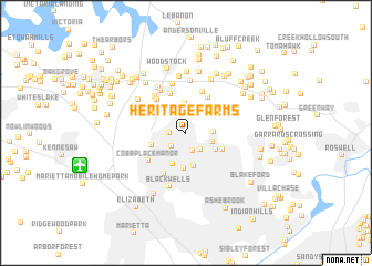
Heritage Farms (Georgia, United States - USA)Heritage Farms is a town in the Georgia region of United States - USA. An overview map of the region around Heritage Farms is displayed below.
regional and 3d topo map of Heritage Farms, United States - USA ::
Heritage Farms airports ::
The nearest airport is MGE - Marietta Dobbins Arb (Atlanta Nas), located 14.2 km south of Heritage Farms.
Other airports nearby include ATL - Hartsfield Jackson Atlanta Intl (45.6 km south), CHA - Chattanooga Lovell Fld (127.5 km north west), ANB - Anniston Metro (135.3 km west), MCN - Macon Middle Georgia Rgnl (169.5 km south east), Nearby towns ::
Blackwell Chase (1.4km west) //
Russell Plantation (1.9km south) //
Oak Creek Estates (1.8km south west) //
Vandiver Heights (2.1km south east) //
Jamerson Forest (2.4km north) //
Carlisle Acres (2.3km east) //
Swanson Heights (2.4km south east) //
Noonday (2.7km north west) //
Willow Creek (3.1km north) //
The Plains (3.0km south east) //
Pine Valley Farms (3.4km south) //
Sandy Plains (3.4km south) //
Lansdowne (3.6km south) //
Addison Heights (3.1km west) //
Holly Oaks (3.5km south east) //
Mountain Ridge (4.0km north east) //
Cherokee Forest (4.1km north) //
Shallowford Forest (4.1km north west) //
Trickum Hills (4.4km north) //
Powell Station (4.5km south west) //
Cobb Place Manor (4.2km south west) //
Kings Crossing (4.2km north west) //
Ridgewood Estates (4.5km north west) //
Lakeside Hills (4.2km north west) //
Stockwood Estates (4.7km north west) //
Skyridge (5.1km north) //
Creek View (5.2km north) //
Indian Valley Estates (5.2km north west) //
Lake Latimer (4.9km north west) //
[all distances 'as the bird flies' and approximate]  Places with similar names to Heritage Farms, United States - USA ::
Disclaimer :: Information on this page comes without warranty of any kind |
||
|
Where is Heritage Farms? Elevation and coordinates ::
Latitude (lat): 34°2'36"N Longitude (lon): 84°30'10"W
Elevation (approx.): 311m (map arrows pan, magnifying glasses zoom) |
||
|
Visiting Heritage Farms? Hotel/Accommodation ::
Book a hotel in Heritage Farms Travel Guide ::
rental cars ::
car rental offers GPS waypoint ::
download a GPX waypoint (PoI) of Heritage Farms for your GPS receiver
|
||