|
search place name
|
||
Indian Hills (Georgia, United States - USA)Indian Hills is a town in the Georgia region of United States - USA. An overview map of the region around Indian Hills is displayed below.
regional and 3d topo map of Indian Hills, United States - USA ::

Indian Hills airports ::
The nearest airport is MGE - Marietta Dobbins Arb (Atlanta Nas), located 78.7 km south west of Indian Hills.
Other airports nearby include ATL - Hartsfield Jackson Atlanta Intl (97.8 km south west), AND - Andersen Anderson Rgnl (108.8 km east), CHA - Chattanooga Lovell Fld (140.0 km north west), TYS - Knoxville Mc Ghee Tyson (157.4 km north), Nearby towns ::
Wahoo Forest (1.0km north east) //
Wahoo Valley (1.0km east) //
Elrod (1.5km north) //
Belvedere Acres (1.6km south) //
Bark Camp Place (1.7km south) //
Brookwood (1.7km south east) //
McCrary (1.8km north east) //
Devane (1.8km east) //
Squirrel Creek (2.1km south east) //
Big Oak (2.2km south west) //
Whelchel (2.1km east) //
Oak Harbor (2.3km south east) //
Sardis Heights (2.6km south west) //
Marlow (2.8km north west) //
Murrayville (3.1km north west) //
Country Club Gardens (3.4km south east) //
Le Dan (3.5km south east) //
Lanier North Woods (3.3km south east) //
Price (3.3km west) //
Greystone (4.0km south) //
Chattahoochee Place (4.2km south east) //
Thompson Mill (4.1km south east) //
Cool Springs Forest (4.1km west) //
Destitute Acres (4.3km south east) //
Mill Creek (4.7km south east) //
Happy Valley (4.7km south east) //
Chapman (4.8km south east) //
Fran Mar Heights (5.4km south) //
North Forest (4.6km west) //
[all distances 'as the bird flies' and approximate] 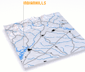 Places with similar names to Indian Hills, United States - USA ::
// Indian Hills (US)
// Indian Hills (US)
// Indian Hills (US)
// Indian Hills (US)
// Indian Hills (US)
// Indian Hills (US)
// Indian Hills (US)
// Indian Hills (US)
// Indian Hills (US)
// Indian Hills (US)
Disclaimer :: Information on this page comes without warranty of any kind |
||
|
Where is Indian Hills? Elevation and coordinates ::
Latitude (lat): 34°23'42"N Longitude (lon): 83°53'14"W
Elevation (approx.): 355m (map arrows pan, magnifying glasses zoom) |
||
|
Visiting Indian Hills? Hotel/Accommodation ::
Book a hotel in Indian Hills Travel Guide ::
rental cars ::
car rental offers GPS waypoint ::
download a GPX waypoint (PoI) of Indian Hills for your GPS receiver
|
||