|
search place name
|
||
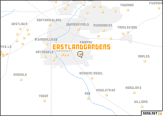
Eastland Gardens (Indiana, United States - USA)Eastland Gardens is a town in the Indiana region of United States - USA. An overview map of the region around Eastland Gardens is displayed below.
regional and 3d topo map of Eastland Gardens, United States - USA ::
Eastland Gardens airports ::
The nearest airport is GUS - Peru Grissom Arb, located 97.8 km south west of Eastland Gardens.
Other airports nearby include DAY - James M Cox Dayton Intl (144.8 km south east), FFO - Dayton Wright Patterson Afb (159.8 km south east), IND - Indianapolis Intl (176.6 km south west), YIP - Detroit Willow Run (188.2 km north east), Nearby towns ::
Anthony Wayne Village (2.2km north) //
Fairfax (2.7km north) //
Westchester (2.5km west) //
Hillcrest (3.0km west) //
Lincolnshire (3.5km west) //
Hessen Cassel (5.0km south) //
Lake Shores (4.5km west) //
Sunnymede Woods (5.8km north east) //
Avalon (4.8km west) //
Dwenger Field (6.7km north) //
Meadowbrook (6.8km north east) //
River Haven (7.5km north east) //
Waynedale (6.3km west) //
Indian Village (6.8km north west) //
Middletown (9.6km south east) //
North Highland (9.5km north west) //
[all distances 'as the bird flies' and approximate] 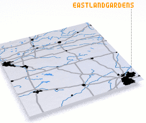 Places with similar names to Eastland Gardens, United States - USA ::
// Eastland Gardens (US)
Disclaimer :: Information on this page comes without warranty of any kind |
||
|
Where is Eastland Gardens? Elevation and coordinates ::
Latitude (lat): 41°1'11"N Longitude (lon): 85°6'1"W
Elevation (approx.): 246m (map arrows pan, magnifying glasses zoom) |
||
|
Visiting Eastland Gardens? Hotel/Accommodation ::
Book a hotel in Eastland Gardens Travel Guide ::
rental cars ::
car rental offers GPS waypoint ::
download a GPX waypoint (PoI) of Eastland Gardens for your GPS receiver
|
||