|
search place name
|
||
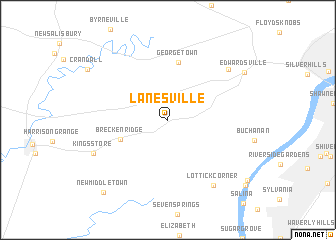
Lanesville (Indiana, United States - USA)Lanesville is a town in the Indiana region of United States - USA. An overview map of the region around Lanesville is displayed below.
regional and 3d topo map of Lanesville, United States - USA ::
Lanesville airports ::
The nearest airport is LOU - Louisville Bowman Fld, located 28.2 km east of Lanesville.
Other airports nearby include FTK - Fort Knox Godman Aaf (36.6 km south), CVG - Cincinnati Northern Kentucky Intl (145.9 km north east), IND - Indianapolis Intl (166.5 km north), LUK - Cincinnati Muni Lunken Fld (166.9 km north east), Nearby towns ::
Breckenridge (4.6km south west) //
Georgetown (6.5km north) //
Duncan (7.8km north east) //
Lottick Corner (8.3km south east) //
Kings Store (7.5km south west) //
Edwardsville (8.5km north east) //
New Middletown (9.9km south west) //
Bridgeport (9.7km south east) //
Locust Point (10.0km south east) //
[all distances 'as the bird flies' and approximate]  Places with similar names to Lanesville, United States - USA ::
// Laïouene Seflia (MA)
// Lanesville (US)
// Linesville (US)
// Lanesville (US)
// Lainsville (US)
// Lanesville (US)
// Lanesville (US)
// Linesville (US)
// Lanceville (US)
// Lanesville (US)
Disclaimer :: Information on this page comes without warranty of any kind |
||
|
Where is Lanesville? Elevation and coordinates ::
Latitude (lat): 38°14'13"N Longitude (lon): 85°59'9"W
Elevation (approx.): 218m (map arrows pan, magnifying glasses zoom) |
||
|
Visiting Lanesville? Hotel/Accommodation ::
Book a hotel in Lanesville Travel Guide ::
rental cars ::
car rental offers GPS waypoint ::
download a GPX waypoint (PoI) of Lanesville for your GPS receiver
|
||