|
search place name
|
||
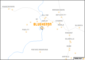
Blue Heron (Kentucky, United States - USA)Blue Heron is a town in the Kentucky region of United States - USA. An overview map of the region around Blue Heron is displayed below.
regional and 3d topo map of Blue Heron, United States - USA ::
Blue Heron airports ::
The nearest airport is TYS - Knoxville Mc Ghee Tyson, located 107.6 km south east of Blue Heron.
Other airports nearby include FTK - Fort Knox Godman Aaf (186.6 km north west), CHA - Chattanooga Lovell Fld (191.0 km south), LOU - Louisville Bowman Fld (199.1 km north west), Nearby towns ::
Comargo (0.8km north east) //
Barthell (2.5km north east) //
Worley (3.3km north) //
Oz (4.4km north west) //
Yamacraw (5.1km north) //
Smith Town (5.0km north east) //
Hill Top (5.8km north) //
White Oak Junction (5.5km north west) //
Hickory Grove (5.3km east) //
Fidelity (5.8km west) //
Co-Operative (6.0km north west) //
Stearns (6.8km north east) //
Revelo (6.8km east) //
Whitley City (8.8km north east) //
Marshes Siding (9.9km north east) //
[all distances 'as the bird flies' and approximate]  Places with similar names to Blue Heron, United States - USA ::
// Balhorn (DE)
// Balhorn (DE)
// Bailāhārāni (BD)
// Bāli Hārina (BD)
// Balīharan (IN)
// Ballyhearin (IE)
Disclaimer :: Information on this page comes without warranty of any kind |
||
|
Where is Blue Heron? Elevation and coordinates ::
Latitude (lat): 36°40'17"N Longitude (lon): 84°32'44"W
Elevation (approx.): 298m (map arrows pan, magnifying glasses zoom) |
||
|
Visiting Blue Heron? Hotel/Accommodation ::
Book a hotel in Blue Heron Travel Guide ::
rental cars ::
car rental offers GPS waypoint ::
download a GPX waypoint (PoI) of Blue Heron for your GPS receiver
|
||