|
search place name
|
||
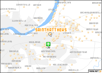
Saint Matthews (Kentucky, United States - USA)Saint Matthews is a town in the Kentucky region of United States - USA. An overview map of the region around Saint Matthews is displayed below.
regional and 3d topo map of Saint Matthews, United States - USA ::
Saint Matthews airports ::
The nearest airport is LOU - Louisville Bowman Fld, located 2.8 km south of Saint Matthews.
Other airports nearby include FTK - Fort Knox Godman Aaf (47.4 km south west), CVG - Cincinnati Northern Kentucky Intl (123.3 km north east), LUK - Cincinnati Muni Lunken Fld (143.2 km north east), IND - Indianapolis Intl (171.7 km north), Nearby towns ::
Bellewood (0.6km north west) //
Cherrywood Village (0.8km north) //
Norbourne Estates (1.0km south east) //
Broad Fields (1.3km south) //
Druid Hills (1.3km north west) //
Seminary Village (1.2km west) //
Brownsboro Village (1.4km north west) //
Maryhill Estates (1.6km north) //
Plymouth Village (1.7km south east) //
Richlawn (1.4km east) //
Springlee (1.8km south east) //
Parkside (1.8km south east) //
Indian Hills (2.3km north) //
Rolling Fields (2.2km north west) //
Fairmeade (2.0km east) //
Cherokee Garden (2.1km south west) //
Beechwood Village (2.1km east) //
Indian Hills Cherokee Section (3.0km north) //
Woodlawn Park (2.5km east) //
Windy Hills (3.0km north east) //
Merrifield (3.2km north east) //
Riverwood (3.4km north) //
Robinswood (3.6km north) //
Seneca Gardens (3.3km south west) //
Winding Falls (3.5km north) //
Mockingbird Valley (3.2km north west) //
Kingsley (3.8km south) //
Meadowview Estates (3.8km south east) //
Crossgate (3.7km north east) //
[all distances 'as the bird flies' and approximate]  Places with similar names to Saint Matthews, United States - USA ::
// Saint Matthews (US)
// Sandimetsa (EE)
// Saint Matthews (ZA)
// Saint Matthews (US)
// Saint-Maudez (FR)
// Saint-Maudez (FR)
// Saint-Modez (FR)
Disclaimer :: Information on this page comes without warranty of any kind |
||
|
Where is Saint Matthews? Elevation and coordinates ::
Latitude (lat): 38°15'10"N Longitude (lon): 85°39'21"W
Elevation (approx.): 168m (map arrows pan, magnifying glasses zoom) |
||
|
Visiting Saint Matthews? Hotel/Accommodation ::
Book a hotel in Saint Matthews Travel Guide ::
rental cars ::
car rental offers GPS waypoint ::
download a GPX waypoint (PoI) of Saint Matthews for your GPS receiver
|
||