|
search place name
|
||
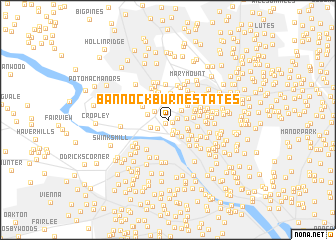
Bannockburn Estates (Maryland, United States - USA)Bannockburn Estates is a town in the Maryland region of United States - USA. An overview map of the region around Bannockburn Estates is displayed below.
regional and 3d topo map of Bannockburn Estates, United States - USA ::
Bannockburn Estates airports ::
The nearest airport is DCA - Ronald Reagan Washington Natl, located 17.4 km south east of Bannockburn Estates.
Other airports nearby include IAD - Washington Dulles Intl (27.1 km west), ADW - Camp Springs Andrews Afb (Washington Dc Naf) (31.0 km south east), BWI - Baltimore Washington Intl (46.6 km north east), APG - Aberdeen Phillips Aaf (100.1 km north east), Nearby towns ::
Kimberley (0.4km south west) //
Bannockburn Heights (0.5km south east) //
Cohasset (0.9km east) //
Bannockburn (1.2km south east) //
Cabin John (1.3km south west) //
Glen Echo (1.7km south) //
Fairway Hills (1.7km south east) //
Emery Corners (1.5km north west) //
Woodhaven (1.6km north east) //
Oakwood Knolls (1.6km east) //
Cabin John Park (1.7km south west) //
Carderock Springs (1.8km west) //
Tulip Hill (2.2km south east) //
Merrimack Park (2.0km south east) //
Woodburn (2.1km south east) //
Bradley Hills Grove (2.4km north east) //
Charred Oak Estates (2.5km north west) //
Hillmead (2.3km north east) //
Burning Tree Estates (2.8km north) //
Landon Village (2.3km east) //
Longwood (3.0km north) //
Bradley Woods (2.5km north east) //
Mohican Hills (2.8km south east) //
Wood Acres (2.7km south east) //
Congressional Manor (2.7km north west) //
Rose Hill Estates (3.1km north) //
Holly Hill (3.1km north west) //
Kenwood Park (2.6km east) //
Green Tree Manor (3.1km north east) //
[all distances 'as the bird flies' and approximate] 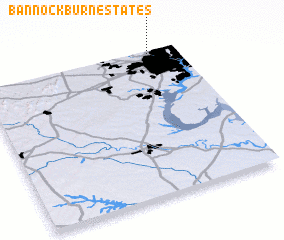 Places with similar names to Bannockburn Estates, United States - USA :: Disclaimer :: Information on this page comes without warranty of any kind |
||
|
Where is Bannockburn Estates? Elevation and coordinates ::
Latitude (lat): 38°59'1"N Longitude (lon): 77°8'51"W
Elevation (approx.): 69m (map arrows pan, magnifying glasses zoom) |
||
|
Visiting Bannockburn Estates? Hotel/Accommodation ::
Book a hotel in Bannockburn Estates Travel Guide ::
rental cars ::
car rental offers GPS waypoint ::
download a GPX waypoint (PoI) of Bannockburn Estates for your GPS receiver
|
||