|
search place name
|
||
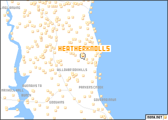
Heather Knolls (Maryland, United States - USA)Heather Knolls is a town in the Maryland region of United States - USA. An overview map of the region around Heather Knolls is displayed below.
regional and 3d topo map of Heather Knolls, United States - USA ::
Heather Knolls airports ::
The nearest airport is NHK - Patuxent River Nas, located 35.8 km south of Heather Knolls.
Other airports nearby include ADW - Camp Springs Andrews Afb (Washington Dc Naf) (37.0 km north west), DCA - Ronald Reagan Washington Natl (51.5 km north west), BWI - Baltimore Washington Intl (65.8 km north), IAD - Washington Dulles Intl (88.1 km north west), Nearby towns ::
Hunt Valley Estates (0.5km east) //
Meadow Creek Estates (1.1km north) //
Tanglewood (1.0km south east) //
Parran Hunt Estates (1.0km west) //
Woodwind Estates (1.7km north) //
Poplar Woods (1.5km south east) //
Baden Estates (1.6km east) //
Biglanes Choice (1.9km north west) //
Fairview Estates (2.1km east) //
Rolling Acres (2.7km north) //
Angelica (2.1km east) //
Oldfield (2.3km north east) //
Parran (2.4km north west) //
Tranquility (2.8km north) //
Pine View Estates (2.3km south east) //
Peach Blossom Farm (2.9km north) //
Parrans Woods (2.8km north west) //
Wilson (2.7km north east) //
Bess-Mar Estates (2.8km north west) //
Deer Crossing (3.5km south) //
Chesapeake Heights on the Bay (3.2km south east) //
Bayview Manor Mobile Home Park (2.8km east) //
Huntingtown Meadows (3.7km north) //
Tobacco Woods (3.5km north east) //
Kingswood Estates (3.6km south) //
Clahamman Hills (3.7km south west) //
Queensberry (3.6km south west) //
Carpenter Beach (3.4km north east) //
Willowbrook Hills (3.9km south west) //
[all distances 'as the bird flies' and approximate] 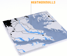 Places with similar names to Heather Knolls, United States - USA :: Disclaimer :: Information on this page comes without warranty of any kind |
||
|
Where is Heather Knolls? Elevation and coordinates ::
Latitude (lat): 38°35'24"N Longitude (lon): 76°32'55"W
Elevation (approx.): 40m (map arrows pan, magnifying glasses zoom) |
||
|
Visiting Heather Knolls? Hotel/Accommodation ::
Book a hotel in Heather Knolls Travel Guide ::
rental cars ::
car rental offers GPS waypoint ::
download a GPX waypoint (PoI) of Heather Knolls for your GPS receiver
|
||