|
search place name
|
||
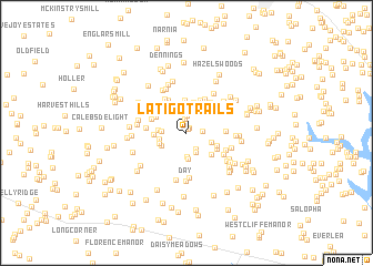
Latigo Trails (Maryland, United States - USA)Latigo Trails is a town in the Maryland region of United States - USA. An overview map of the region around Latigo Trails is displayed below.
regional and 3d topo map of Latigo Trails, United States - USA ::
Latigo Trails airports ::
The nearest airport is BWI - Baltimore Washington Intl, located 43.9 km south east of Latigo Trails.
Other airports nearby include IAD - Washington Dulles Intl (64.2 km south west), DCA - Ronald Reagan Washington Natl (64.3 km south), ADW - Camp Springs Andrews Afb (Washington Dc Naf) (70.8 km south), APG - Aberdeen Phillips Aaf (76.4 km east), Nearby towns ::
Daniel (0.4km north) //
Braddock Manor West (0.6km north) //
Raydan Retreat (1.4km north) //
Stone House Village (1.2km east) //
Winfield (1.8km north) //
Ivy Hill Way (1.7km south east) //
Woodbine Acres (2.1km south) //
Ashley Mobile Home Park (2.4km south) //
Timbermead (1.9km west) //
Picketts Corner (2.6km south) //
Red Fox Meadow (2.2km south east) //
Cumorah Estates (2.2km west) //
McHenry Meadows (2.2km west) //
Eagle Wood Estates (2.4km south west) //
Gillis Falls Estates (2.4km south west) //
Winfield Woods (3.1km north) //
South Carroll Estates (2.9km south east) //
Chestnut Oaks (2.7km south east) //
Winfield Heights (3.3km north) //
Fleming Way Estates (2.6km west) //
Arthur Ridge (2.9km south east) //
Gasnell Estates (2.9km north west) //
Ray-Mar Estates (3.4km north) //
Braddock Estates (3.0km north west) //
Sun Valley (3.6km north west) //
Legos Choice (3.7km north) //
Academy Acres (3.6km north east) //
Montclare (3.5km north east) //
Bushey Heights (3.1km east) //
[all distances 'as the bird flies' and approximate]  Places with similar names to Latigo Trails, United States - USA :: Disclaimer :: Information on this page comes without warranty of any kind |
||
|
Where is Latigo Trails? Elevation and coordinates ::
Latitude (lat): 39°25'53"N Longitude (lon): 77°3'20"W
Elevation (approx.): 233m (map arrows pan, magnifying glasses zoom) |
||
|
Visiting Latigo Trails? Hotel/Accommodation ::
Book a hotel in Latigo Trails Travel Guide ::
rental cars ::
car rental offers GPS waypoint ::
download a GPX waypoint (PoI) of Latigo Trails for your GPS receiver
|
||