|
search place name
|
||
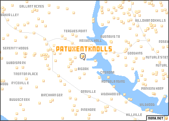
Patuxent Knolls (Maryland, United States - USA)Patuxent Knolls is a town in the Maryland region of United States - USA. An overview map of the region around Patuxent Knolls is displayed below.
regional and 3d topo map of Patuxent Knolls, United States - USA ::
Patuxent Knolls airports ::
The nearest airport is NHK - Patuxent River Nas, located 34.1 km south east of Patuxent Knolls.
Other airports nearby include ADW - Camp Springs Andrews Afb (Washington Dc Naf) (38.3 km north), DCA - Ronald Reagan Washington Natl (49.6 km north west), BWI - Baltimore Washington Intl (76.1 km north), IAD - Washington Dulles Intl (82.6 km north west), Nearby towns ::
Indian River Estates (0.5km north) //
Hidden River (1.7km west) //
Golden Beach (1.9km east) //
Indian Creek Estates (2.7km north) //
Rustic Hills (2.1km west) //
Cooney Neck Estate (2.5km south west) //
Big Oak (3.0km south) //
Quiet Acres (2.5km west) //
Rolling Acres (2.5km west) //
Benedict (3.0km north east) //
Maxwell Hall (3.5km north) //
Huntersville (3.3km south west) //
Holly Acres (3.1km south west) //
Shady Dale (3.9km south) //
Loves (4.4km north west) //
Cellar Hill (4.6km south east) //
Patuxent View (4.1km north east) //
Anchorage Park Mobile Home Park (4.2km north east) //
Burch (4.2km north east) //
Knolland (4.5km west) //
Teagues Point (5.6km north) //
Swanson Creek Landing (6.1km north) //
Leming (5.0km east) //
Cedar Beach (5.2km north east) //
Chickasaw Run (5.0km west) //
Patuxent Woods (5.9km north west) //
Cremona (5.6km south east) //
Wood-N-Dale Estates (5.6km south west) //
Calvert Mobile Home Park (5.5km east) //
[all distances 'as the bird flies' and approximate]  Places with similar names to Patuxent Knolls, United States - USA :: Disclaimer :: Information on this page comes without warranty of any kind |
||
|
Where is Patuxent Knolls? Elevation and coordinates ::
Latitude (lat): 38°29'24"N Longitude (lon): 76°42'15"W
Elevation (approx.): 29m (map arrows pan, magnifying glasses zoom) |
||
|
Visiting Patuxent Knolls? Hotel/Accommodation ::
Book a hotel in Patuxent Knolls Travel Guide ::
rental cars ::
car rental offers GPS waypoint ::
download a GPX waypoint (PoI) of Patuxent Knolls for your GPS receiver
|
||