|
search place name
|
||
Rolling Road Farms (Maryland, United States - USA)Rolling Road Farms is a town in the Maryland region of United States - USA. An overview map of the region around Rolling Road Farms is displayed below.
regional and 3d topo map of Rolling Road Farms, United States - USA ::

Rolling Road Farms airports ::
The nearest airport is BWI - Baltimore Washington Intl, located 17.6 km south east of Rolling Road Farms.
Other airports nearby include APG - Aberdeen Phillips Aaf (52.6 km east), ADW - Camp Springs Andrews Afb (Washington Dc Naf) (57.5 km south), DCA - Ronald Reagan Washington Natl (57.6 km south west), IAD - Washington Dulles Intl (73.9 km south west), Nearby towns ::
Featherbed (0.7km north east) //
Waterford Place (0.8km north west) //
Rolling Heights (0.9km south west) //
Heraldry Square (1.2km west) //
Belmont (1.5km south) //
Rutherford Green (1.9km north) //
Kingswood Common (1.8km north west) //
Chadwick Manor (1.9km south west) //
West Glen (1.8km north east) //
Powhatan (1.8km east) //
Fair Brook (1.9km south west) //
Woodlawn (1.9km east) //
Windsor Mill Manor (2.0km north east) //
Walden Circle (2.4km south east) //
Winsten Estates (2.1km west) //
Woodmoor (2.5km north east) //
Hebbville (2.6km north west) //
Rolling Ridge (2.7km north) //
Westview Park (2.8km south) //
Woodbridge Valley (2.8km south west) //
Adil Meadows (3.0km south) //
Brigadoon (2.8km south east) //
Lynn Acres (3.1km north) //
Catonsville Manor (3.0km south east) //
Milford (3.1km north) //
Parkview Trail (2.7km west) //
Drexel Woods (3.3km south west) //
Westerlee (3.4km south) //
Colonial Park (2.9km south east) //
[all distances 'as the bird flies' and approximate] 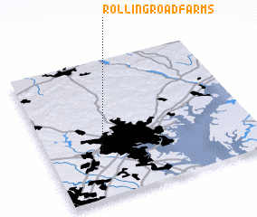 Places with similar names to Rolling Road Farms, United States - USA :: Disclaimer :: Information on this page comes without warranty of any kind |
||
|
Where is Rolling Road Farms? Elevation and coordinates ::
Latitude (lat): 39°19'13"N Longitude (lon): 76°44'59"W
Elevation (approx.): 120m (map arrows pan, magnifying glasses zoom) |
||
|
Visiting Rolling Road Farms? Hotel/Accommodation ::
Book a hotel in Rolling Road Farms Travel Guide ::
rental cars ::
car rental offers GPS waypoint ::
download a GPX waypoint (PoI) of Rolling Road Farms for your GPS receiver
|
||