|
search place name
|
||
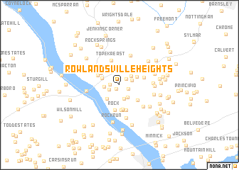
Rowlandsville Heights (Maryland, United States - USA)Rowlandsville Heights is a town in the Maryland region of United States - USA. An overview map of the region around Rowlandsville Heights is displayed below.
regional and 3d topo map of Rowlandsville Heights, United States - USA ::
Rowlandsville Heights airports ::
The nearest airport is APG - Aberdeen Phillips Aaf, located 21.9 km south of Rowlandsville Heights.
Other airports nearby include ILG - Wilmington New Castle (45.2 km east), BWI - Baltimore Washington Intl (70.9 km south west), PHL - Philadelphia Intl (79.9 km east), MDT - Harrisburg Intl (80.0 km north west), Nearby towns ::
New Valley (0.7km south west) //
Mount Pleasant View (1.3km north east) //
Rowlandsville (1.2km west) //
Liberty Grove (1.3km south east) //
The Bluffs (1.4km south west) //
Pleasant View (1.7km north east) //
Holland Acres (2.2km south east) //
Jacks Corner (2.3km south) //
Vinegar Hill (2.0km north east) //
Octoraro (1.9km west) //
West Rock Station (2.6km south west) //
Conowingo Manor (2.3km north west) //
Mount Pleasant Manor (2.5km north east) //
Richardsmere (3.2km north) //
Kilby Corner (2.9km north west) //
Conowingo (2.9km north west) //
Frank (3.3km south east) //
Susquehanna Hills (3.0km north west) //
Rock Run Estates (3.8km south) //
Cardiff (3.9km south) //
Granite Knoll Farms (4.0km south) //
Colora (3.2km east) //
Topeka East (3.9km north) //
Rock (4.0km south) //
Port Heights (4.0km south) //
Octararo Lakes (4.8km north) //
Honeysuckle Hollow (4.4km south east) //
Rock Run (5.2km south) //
Chelsea of Nottingham (4.1km east) //
[all distances 'as the bird flies' and approximate] 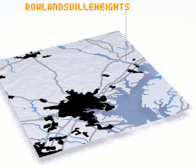 Places with similar names to Rowlandsville Heights, United States - USA :: Disclaimer :: Information on this page comes without warranty of any kind |
||
|
Where is Rowlandsville Heights? Elevation and coordinates ::
Latitude (lat): 39°39'40"N Longitude (lon): 76°8'0"W
Elevation (approx.): 74m (map arrows pan, magnifying glasses zoom) |
||
|
Visiting Rowlandsville Heights? Hotel/Accommodation ::
Book a hotel in Rowlandsville Heights Travel Guide ::
rental cars ::
car rental offers GPS waypoint ::
download a GPX waypoint (PoI) of Rowlandsville Heights for your GPS receiver
|
||