|
search place name
|
||
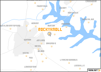
Rocky Knoll (North Carolina, United States - USA)Rocky Knoll is a town in the North Carolina region of United States - USA. An overview map of the region around Rocky Knoll is displayed below.
regional and 3d topo map of Rocky Knoll, United States - USA ::
Rocky Knoll airports ::
The nearest airport is RDU - Raleigh-durham Raleigh Durham Intl, located 15.7 km south of Rocky Knoll.
Other airports nearby include POB - Fayetteville Pope Afb (95.4 km south), GSB - Goldsboro Seymour Johnson Afb (108.4 km south east), INT - Winston-salem Smith Reynolds (126.6 km west), NCA - Jacksonville New River Mcas (192.0 km south east), Nearby towns ::
Glen Forest (1.4km north east) //
Gorman (2.3km north) //
Burton (2.7km north) //
Oak Grove (3.9km south) //
Joyland (3.9km south west) //
Weaver (5.7km north west) //
Hayes (6.1km south west) //
Redwood (5.8km north east) //
Bilboa (7.2km south) //
Braggtown (6.5km west) //
Bethesda (8.3km south) //
Durham (7.2km west) //
Mill Grove (8.2km north west) //
North Side (10.3km north east) //
[all distances 'as the bird flies' and approximate] 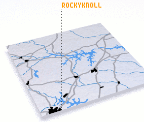 Places with similar names to Rocky Knoll, United States - USA ::
// Rocky Knoll (US)
Disclaimer :: Information on this page comes without warranty of any kind |
||
|
Where is Rocky Knoll? Elevation and coordinates ::
Latitude (lat): 36°0'58"N Longitude (lon): 78°49'26"W
Elevation (approx.): 119m (map arrows pan, magnifying glasses zoom) |
||
|
Visiting Rocky Knoll? Hotel/Accommodation ::
Book a hotel in Rocky Knoll Travel Guide ::
rental cars ::
car rental offers GPS waypoint ::
download a GPX waypoint (PoI) of Rocky Knoll for your GPS receiver
|
||