|
search place name
|
||
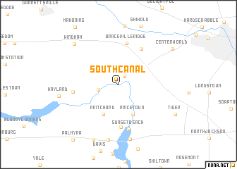
South Canal (Ohio, United States - USA)South Canal is a town in the Ohio region of United States - USA. An overview map of the region around South Canal is displayed below.
regional and 3d topo map of South Canal, United States - USA ::
South Canal airports ::
The nearest airport is YNG - Youngstown Warren Rgnl, located 27.4 km east of South Canal.
Other airports nearby include AKR - Akron Fulton Intl (43.2 km west), CLE - Cleveland Hopkins Intl (76.8 km west), PIT - Pittsburgh (pennsylva) Pittsburgh Intl (99.2 km south east), YQG - Windsor (204.2 km north west), Nearby towns ::
Newton Falls (1.4km north east) //
McClintocksburg (2.6km west) //
Pricetown (5.1km south) //
Pritchard (5.1km south) //
Braceville Ridge (6.6km north) //
Craig Beach (6.7km south) //
Braceville (6.3km north east) //
Paris (5.5km west) //
Sunset Beach (7.2km south) //
Lake Milton (8.8km south) //
Flicks Corners (8.8km south) //
Windham (8.3km north west) //
Diamond (9.2km south) //
Center World (8.6km north east) //
Palmyra (10.3km south west) //
[all distances 'as the bird flies' and approximate] 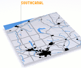 Places with similar names to South Canal, United States - USA :: Disclaimer :: Information on this page comes without warranty of any kind |
||
|
Where is South Canal? Elevation and coordinates ::
Latitude (lat): 41°10'38"N Longitude (lon): 80°59'13"W
Elevation (approx.): 295m (map arrows pan, magnifying glasses zoom) |
||
|
Visiting South Canal? Hotel/Accommodation ::
Book a hotel in South Canal Travel Guide ::
rental cars ::
car rental offers GPS waypoint ::
download a GPX waypoint (PoI) of South Canal for your GPS receiver
|
||