|
search place name
|
||
Brownsville (Pennsylvania, United States - USA)Brownsville is a town in the Pennsylvania region of United States - USA. An overview map of the region around Brownsville is displayed below.
regional and 3d topo map of Brownsville, United States - USA ::

Brownsville airports ::
The nearest airport is PIT - Pittsburgh (pennsylva) Pittsburgh Intl, located 59.8 km north west of Brownsville.
Other airports nearby include EKN - Elkins Randolph Co Jennings Randolph (125.9 km south), AOO - Altoona Blair Co (136.7 km east), YNG - Youngstown Warren Rgnl (153.0 km north west), AKR - Akron Fulton Intl (175.1 km north west), Nearby towns ::
West Brownsville (0.6km west) //
Blainsburg (1.0km north) //
Knoxville (1.1km south east) //
Century (1.5km south) //
Albany (1.9km north east) //
Hiller (2.1km south west) //
Linn (2.3km east) //
Braznell (2.6km east) //
Denbeau Heights (2.7km west) //
Superior (3.6km south) //
Chamouni (4.0km north) //
Allison Heights (4.2km south) //
Philipsburg (4.2km north) //
Allison (4.2km south east) //
California (4.7km north) //
Alica (4.2km south west) //
Coal Center (5.2km north) //
Malden Place (4.3km west) //
Denbo (4.3km west) //
Granville (5.3km north west) //
Merrittstown (5.7km south) //
Davidson (5.0km south east) //
Marchandville (5.7km north) //
Kenneth (5.4km north east) //
Newell (5.9km north) //
Grindstone (4.6km east) //
Wood Run (6.0km north) //
Elco (6.1km north) //
Smallwood (5.8km north west) //
[all distances 'as the bird flies' and approximate] 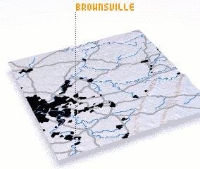 Places with similar names to Brownsville, United States - USA ::
// Barnesville (US)
// Barnesville (US)
// Brownsville (US)
// Burnsville (US)
// Brownsville (US)
// Brownsville (US)
// Brownsville (US)
// Browns Valley (US)
// Brownsville (US)
// Barnesville (US)
Disclaimer :: Information on this page comes without warranty of any kind |
||
|
Where is Brownsville? Elevation and coordinates ::
Latitude (lat): 40°1'25"N Longitude (lon): 79°53'3"W
Elevation (approx.): 237m (map arrows pan, magnifying glasses zoom) |
||
|
Visiting Brownsville? Hotel/Accommodation ::
Book a hotel in Brownsville Travel Guide ::
rental cars ::
car rental offers GPS waypoint ::
download a GPX waypoint (PoI) of Brownsville for your GPS receiver
|
||