|
search place name
|
||
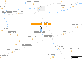
Canadohta Lake (Pennsylvania, United States - USA)Canadohta Lake is a town in the Pennsylvania region of United States - USA. An overview map of the region around Canadohta Lake is displayed below.
regional and 3d topo map of Canadohta Lake, United States - USA ::
Canadohta Lake airports ::
The nearest airport is YNG - Youngstown Warren Rgnl, located 93.4 km south west of Canadohta Lake.
Other airports nearby include PIT - Pittsburgh (pennsylva) Pittsburgh Intl (150.6 km south), YHM - Hamilton (151.3 km north), BUF - Buffalo Niagara Intl (154.7 km north east), IAG - Niagara Falls Intl (161.2 km north east), Nearby towns ::
Lakeville (1.0km south west) //
Lincolnville (2.2km south) //
Tillotson (2.7km north east) //
Riceville (4.8km south east) //
Rootville (5.3km south west) //
Little Cooley (9.5km south west) //
Centerville (10.5km south east) //
[all distances 'as the bird flies' and approximate] 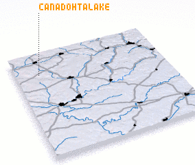 Places with similar names to Canadohta Lake, United States - USA ::
// Quinta da Légua (PT)
// Canto del Agua (CL)
// Canto del Agua (BO)
// Cañada del Agua (DO)
// Canto da Lagoa (BR)
// Cañada de Luque (AR)
Disclaimer :: Information on this page comes without warranty of any kind |
||
|
Where is Canadohta Lake? Elevation and coordinates ::
Latitude (lat): 41°48'49"N Longitude (lon): 79°50'6"W
Elevation (approx.): 428m (map arrows pan, magnifying glasses zoom) |
||
|
Visiting Canadohta Lake? Hotel/Accommodation ::
Book a hotel in Canadohta Lake Travel Guide ::
rental cars ::
car rental offers GPS waypoint ::
download a GPX waypoint (PoI) of Canadohta Lake for your GPS receiver
|
||