|
search place name
|
||
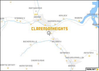
Clarendon Heights (Pennsylvania, United States - USA)Clarendon Heights is a town in the Pennsylvania region of United States - USA. An overview map of the region around Clarendon Heights is displayed below.
regional and 3d topo map of Clarendon Heights, United States - USA ::
Clarendon Heights airports ::
The nearest airport is BUF - Buffalo Niagara Intl, located 131.3 km north of Clarendon Heights.
Other airports nearby include YNG - Youngstown Warren Rgnl (143.9 km south west), IAG - Niagara Falls Intl (146.8 km north), YHM - Hamilton (168.0 km north west), PIT - Pittsburgh (pennsylva) Pittsburgh Intl (172.6 km south west), Nearby towns ::
Stoneham (1.0km north east) //
Clarendon (1.6km south east) //
Old Clarendon (2.0km south) //
Rogertown (3.5km north) //
Glade (4.2km north) //
Weldbank (4.1km south east) //
Shipmans Eddy (4.5km north) //
Tiona (5.9km south east) //
East Warren (6.7km north west) //
Warren (6.7km north west) //
Buchers Mills (6.3km south west) //
South Warren (6.8km north west) //
Hemlock (7.5km north east) //
Hazeltine Corners (8.8km north west) //
Saybrook (8.8km south east) //
Venturetown (9.0km north west) //
[all distances 'as the bird flies' and approximate]  Places with similar names to Clarendon Heights, United States - USA :: Disclaimer :: Information on this page comes without warranty of any kind |
||
|
Where is Clarendon Heights? Elevation and coordinates ::
Latitude (lat): 41°47'29"N Longitude (lon): 79°6'20"W
Elevation (approx.): 430m (map arrows pan, magnifying glasses zoom) |
||
|
Visiting Clarendon Heights? Hotel/Accommodation ::
Book a hotel in Clarendon Heights Travel Guide ::
rental cars ::
car rental offers GPS waypoint ::
download a GPX waypoint (PoI) of Clarendon Heights for your GPS receiver
|
||