|
search place name
|
||
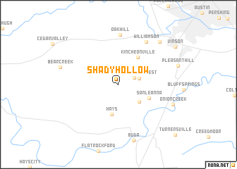
Shady Hollow (Texas, United States - USA)Shady Hollow is a town in the Texas region of United States - USA. An overview map of the region around Shady Hollow is displayed below.
regional and 3d topo map of Shady Hollow, United States - USA ::
Shady Hollow airports ::
The nearest airport is AUS - Austin Bergstrom Intl, located 18.8 km east of Shady Hollow.
Other airports nearby include RND - San Antonio Randolph Afb (81.1 km south west), SAT - San Antonio Intl (91.3 km south west), GRK - Killeen Robert Gray Aaf (100.1 km north), HLR - Fort Hood Hood Aaf (108.9 km north), Nearby towns ::
Tanglewood Forest (2.5km north east) //
Ford Oaks (3.0km east) //
Manchaca (3.9km south east) //
Hays (4.8km south) //
Kincheonville (5.0km north east) //
San Leanna (4.8km south east) //
Oak Hill (7.8km north) //
Williamson (7.8km north east) //
Buda (9.1km south) //
Onion Creek (8.1km south east) //
Sunset Valley (8.8km north east) //
[all distances 'as the bird flies' and approximate] 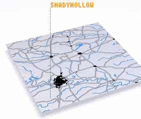 Places with similar names to Shady Hollow, United States - USA ::
Disclaimer :: Information on this page comes without warranty of any kind |
||
|
Where is Shady Hollow? Elevation and coordinates ::
Latitude (lat): 30°9'53"N Longitude (lon): 97°51'43"W
Elevation (approx.): 234m (map arrows pan, magnifying glasses zoom) |
||
|
Visiting Shady Hollow? Hotel/Accommodation ::
Book a hotel in Shady Hollow Travel Guide ::
rental cars ::
car rental offers GPS waypoint ::
download a GPX waypoint (PoI) of Shady Hollow for your GPS receiver
|
||