|
search place name
|
||
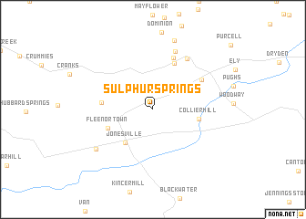
Sulphur Springs (Virginia, United States - USA)Sulphur Springs is a town in the Virginia region of United States - USA. An overview map of the region around Sulphur Springs is displayed below.
regional and 3d topo map of Sulphur Springs, United States - USA ::
Sulphur Springs airports ::
The nearest airport is TYS - Knoxville Mc Ghee Tyson, located 130.5 km south west of Sulphur Springs.
Other airports nearby include HKY - Hickory Rgnl (187.2 km south east), Nearby towns ::
Ben Hur (0.8km north) //
Jonesville (4.9km south west) //
Collier Mill (4.7km east) //
Fleenortown (5.0km south west) //
Stone Creek (6.0km north) //
Ocoonita (5.1km west) //
Maness (6.6km north) //
Pennington Gap (6.0km north east) //
Pocket (7.1km north east) //
Penn Lee (7.5km north) //
Jonesville Camp Ground (7.4km south west) //
Saint Charles (8.7km north) //
[all distances 'as the bird flies' and approximate] 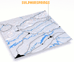 Places with similar names to Sulphur Springs, United States - USA ::
// Sulpher Springs (US)
// Sulphur Springs (US)
// Sulphur Springs (US)
// Sulphur Springs (US)
// Sulphur Springs (US)
// Sulphur Springs (US)
// Sulphur Springs (US)
// Sulphur Springs (US)
// Sulphur Springs (US)
// Sulphur Springs (US)
Disclaimer :: Information on this page comes without warranty of any kind |
||
|
Where is Sulphur Springs? Elevation and coordinates ::
Latitude (lat): 36°43'32"N Longitude (lon): 83°4'51"W
Elevation (approx.): 465m (map arrows pan, magnifying glasses zoom) |
||
|
Visiting Sulphur Springs? Hotel/Accommodation ::
Book a hotel in Sulphur Springs Travel Guide ::
rental cars ::
car rental offers GPS waypoint ::
download a GPX waypoint (PoI) of Sulphur Springs for your GPS receiver
|
||