|
search place name
|
||
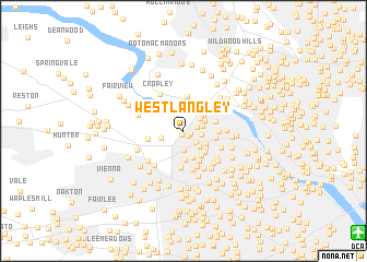
West Langley (Virginia, United States - USA)West Langley is a town in the Virginia region of United States - USA. An overview map of the region around West Langley is displayed below.
regional and 3d topo map of West Langley, United States - USA ::
West Langley airports ::
The nearest airport is DCA - Ronald Reagan Washington Natl, located 17.4 km south east of West Langley.
Other airports nearby include IAD - Washington Dulles Intl (22.3 km west), ADW - Camp Springs Andrews Afb (Washington Dc Naf) (32.5 km south east), BWI - Baltimore Washington Intl (52.5 km north east), NHK - Patuxent River Nas (100.3 km south east), Nearby towns ::
Elmwood Estates (0.4km south west) //
Balls Hill (0.7km south east) //
Old Dominion Gardens (0.6km east) //
Broyhill-Langley Estates (1.2km east) //
Swinks Mill (1.4km north west) //
Broyhill-McLean Estates (1.5km south east) //
Ingleside (1.5km east) //
Lewinsville (1.9km south) //
The Cloisters (1.6km east) //
River Oaks (1.8km north east) //
West McLean (2.0km south east) //
McLean Hamlet (1.9km west) //
Langley Forest (2.0km north east) //
Parkview Hills (2.3km north east) //
McLean (2.2km south east) //
Bryn Mawr (2.5km south east) //
Lewinsville Heights (2.8km south) //
Olney Park (3.0km south) //
McLean Manor (2.7km south east) //
Rosemont (2.9km south east) //
Salona Village (2.7km east) //
Langley Oaks (2.7km east) //
Southridge (3.3km south east) //
Carderock (3.5km north) //
Walter Heights (2.8km east) //
Pimmit Hills (3.7km south) //
Odricks Corner (3.0km west) //
Devon Park (3.7km south) //
Southampton Forest (4.0km south) //
[all distances 'as the bird flies' and approximate] 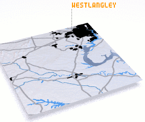 Places with similar names to West Langley, United States - USA :: Disclaimer :: Information on this page comes without warranty of any kind |
||
|
Where is West Langley? Elevation and coordinates ::
Latitude (lat): 38°56'46"N Longitude (lon): 77°11'55"W
Elevation (approx.): 90m (map arrows pan, magnifying glasses zoom) |
||
|
Visiting West Langley? Hotel/Accommodation ::
Book a hotel in West Langley Travel Guide ::
rental cars ::
car rental offers GPS waypoint ::
download a GPX waypoint (PoI) of West Langley for your GPS receiver
|
||