|
search place name
|
||
An Thanh (1) (Quảng Nam-Ðà Nẵng, Vietnam)An Thanh (1) is a town in the Quảng Nam-Ðà Nẵng region of Vietnam. An overview map of the region around An Thanh (1) is displayed below.
regional and 3d topo map of An Thanh (1), Vietnam ::

An Thanh (1) airports ::
The nearest airport is DAD - Danang Intl, located 37.5 km north west of An Thanh (1).
Nearby towns ::
Trà Ðóa (2) (0.0km north) //
Phước Châu (1) (0.0km north) //
An Giáo (1.9km north) //
Hà Bình (1) (1.8km east) //
Phước Ấm (2) (1.9km south) //
Vân Ðóa (1.9km south) //
Tân An (1) (2.6km north east) //
Bình Trung (2.6km north west) //
Ngọc Sơn (1) (3.6km west) //
Vân Tây (1) (3.7km south) //
Bình Yên (4.1km north east) //
Hà Tây (4.1km north east) //
Tiên Phước (4.0km south east) //
An Phú Phương (1) (4.1km north west) //
Vân Tây (2) (4.1km south east) //
Hương Mỹ (1) (4.1km south east) //
Tât Viên (3) (4.1km south west) //
Vân Ðông (5.1km south east) //
Ha Lam (5.1km south west) //
Thăng Bình (5.1km south west) //
Bào Bình Hạ (5.6km north) //
Liêu Trì (1) (5.4km west) //
Tú An (1) (5.8km south) //
Châu Khê (1) (6.6km south east) //
Chung Phước (2) (6.6km south west) //
Lạc Câu (6.6km north west) //
Bình Tịnh (6.5km south east) //
Thanh Ly (2) (6.5km south west) //
Tú An (2) (7.4km south) //
[all distances 'as the bird flies' and approximate] 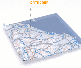 Places with similar names to An Thanh (1), Vietnam ::
// An Thành (1) (VN)
// An Thinh (1) (VN)
Disclaimer :: Information on this page comes without warranty of any kind |
||
|
Where is An Thanh (1)? Elevation and coordinates ::
Latitude (lat): 15°46'0"N Longitude (lon): 108°24'0"E
(map arrows pan, magnifying glasses zoom) |
||
|
Visiting An Thanh (1)? Hotel/Accommodation ::
Book a hotel in An Thanh (1) Travel Guide ::
Buy a travel guide for Vietnam rental cars ::
car rental offers GPS waypoint ::
download a GPX waypoint (PoI) of An Thanh (1) for your GPS receiver
|
||