|
search place name
|
||
Ấp Ðông Hòa (An Giang, Vietnam)Ấp Ðông Hòa is a town in the An Giang region of Vietnam. An overview map of the region around Ấp Ðông Hòa is displayed below.
regional and 3d topo map of Ấp Ðông Hòa, Vietnam ::

Ấp Ðông Hòa airports ::
The nearest airport is PNH - Phnom-penh Phnom Penh Intl, located 99.5 km north of Ấp Ðông Hòa.
Other airports nearby include SGN - Ho Chi Minh City Tansonnhat Intl (177.8 km east), Nearby towns ::
Ấp Tây Hưng (2.6km south west) //
Bến Ðá (3.6km east) //
Cây Mit (4.1km south west) //
Ấp Vĩnh Phú (4.1km north east) //
Vĩnh Tế (5.5km east) //
Ấp Vĩnh Tây (2) (5.5km east) //
Ấp Sơn Tây (5.9km south) //
Ấp Vĩnh Ðông (5.8km east) //
Nhà Bàng (6.6km south west) //
Hồ Ðá (7.4km south) //
Ngã Ba Lâm Giồ (7.6km south) //
Ấp Phú Nhứt (8.2km south west) //
Sóc Tà Ngao (9.2km south west) //
Phumĭ Bântéay Thléay (10.4km north west) //
Ấp Cà Lanh Tamung (10.4km south west) //
Ấp Giửa (10.4km south west) //
Ấp Vĩnh An (10.4km north east) //
[all distances 'as the bird flies' and approximate] 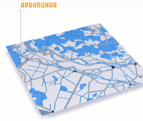 Places with similar names to Ấp Ðông Hòa, Vietnam ::
Disclaimer :: Information on this page comes without warranty of any kind |
||
|
Where is Ấp Ðông Hòa? Elevation and coordinates ::
Latitude (lat): 10°40'0"N Longitude (lon): 105°2'0"E
Elevation (approx.): 1m (map arrows pan, magnifying glasses zoom) |
||
|
Visiting Ấp Ðông Hòa? Hotel/Accommodation ::
Book a hotel in Ấp Ðông Hòa Travel Guide ::
Buy a travel guide for Vietnam rental cars ::
car rental offers GPS waypoint ::
download a GPX waypoint (PoI) of Ấp Ðông Hòa for your GPS receiver
|
||