|
search place name
|
||
Ấp Tào Lột (1) (Long An, Vietnam)Ấp Tào Lột (1) is a town in the Long An region of Vietnam. An overview map of the region around Ấp Tào Lột (1) is displayed below.
regional and 3d topo map of Ấp Tào Lột (1), Vietnam ::

Ấp Tào Lột (1) airports ::
The nearest airport is SGN - Ho Chi Minh City Tansonnhat Intl, located 71.3 km east of Ấp Tào Lột (1).
Other airports nearby include PNH - Phnom-penh Phnom Penh Intl (148.9 km north west), Nearby towns ::
Tào Lột (2.6km south east) //
Ấp Cây Cám (2.6km north west) //
Bình Hòa Thôn (4.1km south west) //
Dinh Ðiền Quảng Hữu (5.2km south west) //
Phumĭ Prey Rôbaeus (5.2km north east) //
Ấp Gò Vồ (6.6km south west) //
Phumĭ Kândal (6.6km north east) //
Bình Hiệp (7.3km west) //
Xóm Ông Tớn (7.3km west) //
Ấp Xóm Mới (8.3km south west) //
Ấp Gò Dưa (8.2km south west) //
Chântréa (8.2km north east) //
Phumĭ Prey Vôllĭ (8.2km north west) //
Khŭm Thmei (8.2km north west) //
Phumĭ Traôk (9.2km north east) //
Ấp Bên Xoài (9.2km north west) //
Phumĭ Tnaôt (9.2km north east) //
Phumĭ Trâpeăng Trav (9.2km north west) //
Mộc Hóa (10.4km south west) //
[all distances 'as the bird flies' and approximate] 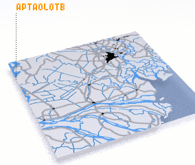 Places with similar names to Ấp Tào Lột (1), Vietnam ::
// Ấp Tà Lọt (1) (VN)
Disclaimer :: Information on this page comes without warranty of any kind |
||
|
Where is Ấp Tào Lột (1)? Elevation and coordinates ::
Latitude (lat): 10°50'0"N Longitude (lon): 106°0'0"E
Elevation (approx.): 3m (map arrows pan, magnifying glasses zoom) |
||
|
Visiting Ấp Tào Lột (1)? Hotel/Accommodation ::
Book a hotel in Ấp Tào Lột (1) Travel Guide ::
Buy a travel guide for Vietnam rental cars ::
car rental offers GPS waypoint ::
download a GPX waypoint (PoI) of Ấp Tào Lột (1) for your GPS receiver
|
||