|
search place name
|
||
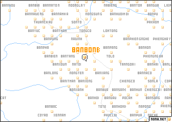
Bản Bôn (1) (Sơn La, Vietnam)Bản Bôn (1) is a town in the Sơn La region of Vietnam. An overview map of the region around Bản Bôn (1) is displayed below.
regional and 3d topo map of Bản Bôn (1), Vietnam ::
Bản Bôn (1) airports ::
The nearest airport is LPQ - Luang Prabang Luang Phabang Intl, located 233.4 km south west of Bản Bôn (1).
Nearby towns ::
Nong Ỏ (1.7km east) //
Bản Tát (1.7km east) //
Bắc Cường (1.9km north) //
Bản Phặng (1.9km north) //
Bản Tát (1.9km south) //
Bản Chan (1.9km south) //
Bản Lay (2) (1.7km west) //
Bon Phặng (1.7km west) //
Bản Co Phu (2.5km north east) //
Nam Tiến (2.5km south east) //
Bản Khoang (2.5km north west) //
Bản Ðẩy (2.5km south west) //
NàTói (2.5km south west) //
Bản Chiềng Puốc (3.7km north) //
Bản May (3.7km north) //
Bản Na Ten (3.7km south) //
Bản Tang (3.5km west) //
Bản Na It (3.5km west) //
Nà Ðính (4.1km north west) //
Chiềng Pấc (4.1km north west) //
Bản Chum (4.1km north west) //
Nong Ten (4.1km south west) //
Bản Pái (4.1km south west) //
Bản Lòng Lo (3.9km south west) //
Ba Na Tong (3.9km south west) //
Bản Quang (5.1km south east) //
Bản Xàng (5.1km south east) //
Tò Lọ (5.2km east) //
Bản Phúc (5.2km west) //
[all distances 'as the bird flies' and approximate]  Places with similar names to Bản Bôn (1), Vietnam ::
// Banbanaba (PH)
// Ban Bang Hoi (1) (TH)
// Ban Na Bon (1) (TH)
// Ban O1 Noi (1) (TH)
// Ban Naban (1) (LA)
// Ban Na Bon (1) (LA)
// Bản Bản (1) (VN)
Disclaimer :: Information on this page comes without warranty of any kind |
||
|
Where is Bản Bôn (1)? Elevation and coordinates ::
Latitude (lat): 21°22'0"N Longitude (lon): 103°46'0"E
Elevation (approx.): 868m (map arrows pan, magnifying glasses zoom) |
||
|
Visiting Bản Bôn (1)? Hotel/Accommodation ::
Book a hotel in Bản Bôn (1) Travel Guide ::
Buy a travel guide for Vietnam rental cars ::
car rental offers GPS waypoint ::
download a GPX waypoint (PoI) of Bản Bôn (1) for your GPS receiver
|
||