|
search place name
|
||
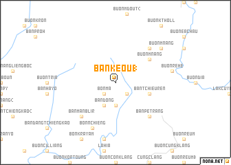
Ban Kêou (1) (Lâm Ðồng, Vietnam)Ban Kêou (1) is a town in the Lâm Ðồng region of Vietnam. An overview map of the region around Ban Kêou (1) is displayed below.
regional and 3d topo map of Ban Kêou (1), Vietnam ::
Ban Kêou (1) airports ::
The nearest airport is NHA - Nhatrang, located 80.1 km east of Ban Kêou (1).
Other airports nearby include SGN - Ho Chi Minh City Tansonnhat Intl (260.5 km south west), Nearby towns ::
Ban Kêou (2) (2.6km south east) //
Bon Mâ (2.6km south west) //
Ban Dang (3.7km south) //
Ban Ðơng (4.1km south west) //
Ban Tchieuren (5.7km east) //
Buôn Mnang (6.6km north east) //
Ban Pé Trang (7.8km south east) //
Buôn R'hang (7.8km north east) //
Ban Manblir (7.8km south west) //
Bon N'chiêng (8.3km south west) //
Buôn Mnang (9.1km north east) //
[all distances 'as the bird flies' and approximate] 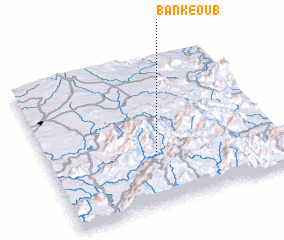 Places with similar names to Ban Kêou (1), Vietnam ::
// Bongabo (PH)
// Bang Bo (TH)
// Ban Kao Bo (TH)
// Ban Kiu (1) (TH)
// Ban Ko Boi (TH)
// Ban Ku Bu (TH)
// Ban Ngua Ba (TH)
// Bongabe (MG)
// Bongabe (MG)
// Banigbé (BJ)
Disclaimer :: Information on this page comes without warranty of any kind |
||
|
Where is Ban Kêou (1)? Elevation and coordinates ::
Latitude (lat): 12°21'0"N Longitude (lon): 108°28'0"E
Elevation (approx.): 1036m (map arrows pan, magnifying glasses zoom) |
||
|
Visiting Ban Kêou (1)? Hotel/Accommodation ::
Book a hotel in Ban Kêou (1) Travel Guide ::
Buy a travel guide for Vietnam rental cars ::
car rental offers GPS waypoint ::
download a GPX waypoint (PoI) of Ban Kêou (1) for your GPS receiver
|
||