|
search place name
|
||
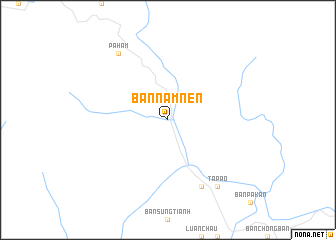
Bản Nam Nen (Lai Châu, Vietnam)Bản Nam Nen is a town in the Lai Châu region of Vietnam. An overview map of the region around Bản Nam Nen is displayed below.
regional and 3d topo map of Bản Nam Nen, Vietnam ::
Bản Nam Nen airports ::
The nearest airport is LPQ - Luang Prabang Luang Phabang Intl, located 245.7 km south west of Bản Nam Nen.
Nearby towns ::
Bản Pa Hon (8.2km south east) //
Pa Hàm (9.0km north west) //
Ta Pao (9.0km south east) //
[all distances 'as the bird flies' and approximate] 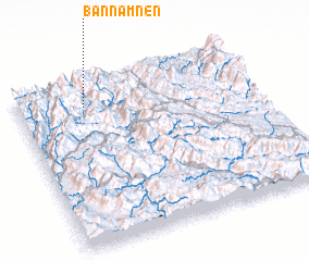 Places with similar names to Bản Nam Nen, Vietnam ::
// Ban Mae Non (TH)
// Ban Nam Nan (TH)
// Banī Minayn (EG)
// Ban Mènon (LA)
// Ban Munnan (LA)
// Ban Namnèn (LA)
// Ban Namnon (LA)
// Ban M'nien (VN)
Disclaimer :: Information on this page comes without warranty of any kind |
||
|
Where is Bản Nam Nen? Elevation and coordinates ::
Latitude (lat): 21°51'0"N Longitude (lon): 103°17'0"E
Elevation (approx.): 260m (map arrows pan, magnifying glasses zoom) |
||
|
Visiting Bản Nam Nen? Hotel/Accommodation ::
Book a hotel in Bản Nam Nen Travel Guide ::
Buy a travel guide for Vietnam rental cars ::
car rental offers GPS waypoint ::
download a GPX waypoint (PoI) of Bản Nam Nen for your GPS receiver
|
||